back to school, school bus, student, tracking, telematics, gps, parents

Back to School Brings New Telematics Opportunities For Bus Fleets

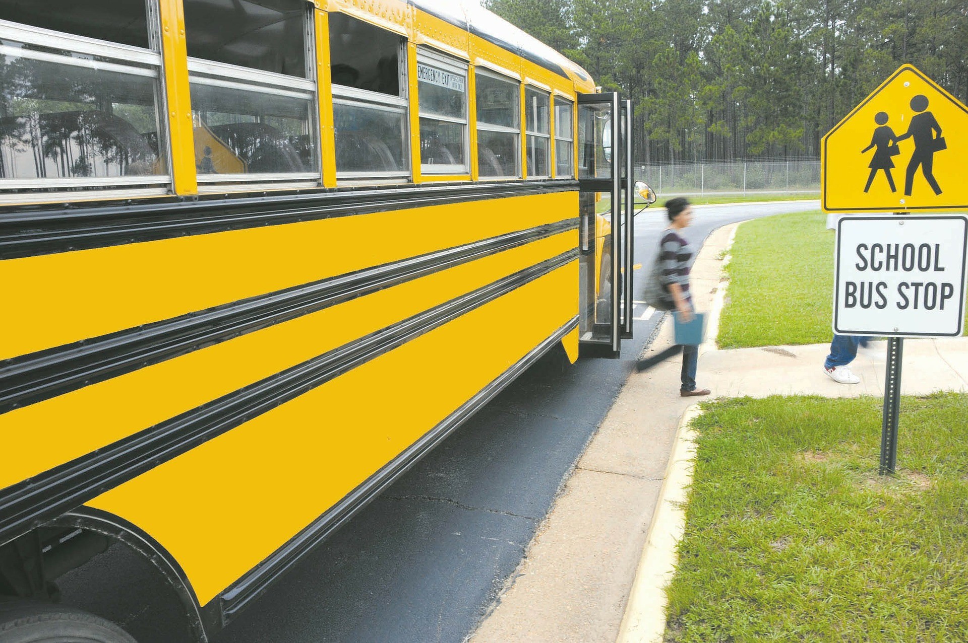
This month marks the back-to-school season, offering students across the country a mass exodus from lockdowns and a welcome break from online learning. These new beginnings bring with them opportunities for school administrators and third-party fleet managers to revamp their bus operations using technology and telematics data to make the school year safer and more efficient. Below we’ve listed some of GoFleet’s product and service offerings that are available to both schools and to the public to help keep kids safe.


GPS tracking of bus operations with Bus ETA


GoFleet’s Bus ETA app marks the first step in safety and communication between parents and their child’s school. Bus ETA is an app that allows school admins to provide live location updates of arriving or departing school buses. 


The app also allows parents to track their child’s bus to make sure it arrives/departs on time by allowing the parent to create routes and define which students (or “Travellers”) are assigned to those routes. Bus ETA is updated automatically, so that parents (or “Guardians”) have access to real-time updates on their computers, tablets, or mobile devices.


Bus ETA is integrated with ZenduIT ecosystem (same functionality as ZenduCAM alerts) to create and review multiple routes, monitor multiple travellers and allow their guardians to log their information in the event of an emergency. A 2-step verification process ensures safe guardian login.


Knowing when and where a school bus will be at any given time — and having that information available on a live app — improves efficiency by reducing wait times and avoids having to wade through a field of update calls from anxious parents. Routing and dispatching can be done quickly, providing a live location for all buses employed by the school and increasing visibility between parents and the school’s administration. 


The school can import and manage guardians and travellers while creating and managing routes from the travellers addresses. Conversely, guardians can track several bus routes and travellers from one mobile app while reviewing a history of arrivals and notifications. Ultimately, knowing when and where a bus will arrive allows families to organize their day without the fear of missing a ride to school. 


Tracking student safety with GO9 trackers


It’s all well and good to know where the bus is, but what if your child isn’t on it? Thankfully, Bus ETA can merge seamlessly with ZenduIT’s tracking system for a more comprehensive (and safer) solution. For example, our third-party GO9 tracker plugs directly into the vehicle to track its routes, and a traveller tag tracks the student’s mobility when used in conjunction with a GO9 + NFC reader. Whether you’re tracking your child’s bus, or tracking the bus and your child, our technology gives schools and parents peace of mind while promoting safe travel to and from school.


ZenduCAM for heightened safety


Our commercial dash cam solutions provide a wealth of options for fleets of all sizes. Connecting a product such as ZenduCAM to your buses gives you data sets for all kinds of cost-saving and safety-promoting initiatives, including:

  • Accident reconstruction: In the unlikely event of an accident, ZenduCAM helps you determine who was at fault, as well as the events that led up to the collision.
  • Road compliance: Dash cams keep your bus drivers accountable by preventing unsafe driving habits such as rapid acceleration, harsh braking and turning.
  • Passenger-facing cameras can help scan your precious cargo to keep them safe and accounted for.
  • Driver scoring and training: Your dash cam system provides an overall scoring system to help identify areas of improvement, incentivize good driving habits and keep drivers and students safe.


When integrated with GoFleet’s rich telematics ecosystem, Bus ETA can help create a 360 solution for schools and bus fleets. Through years of IoT experience, our specialists have a wealth of knowledge and an ability to recommend the right integration of apps and hardware for different verticals. We design, develop and implement premium automation solutions to help drive success — and your vehicles. Contact your GoFleet consultant today and see how we can bring your bus fleet to the top of the class.

asset trackers, tracking, business, fleet

How The Frequency Of Asset Tracking Updates Makes A Difference

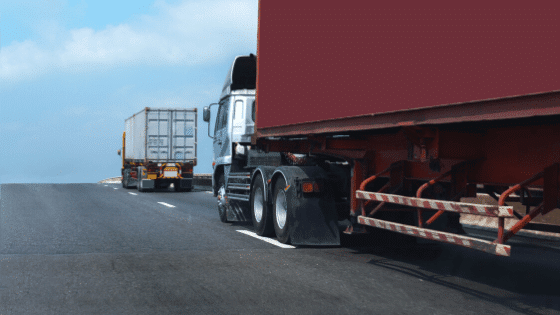
Telematics has been the key to improving fleets over the past several years. It all began with asset trackers, a solution to track data about various aspects of a vehicle to enhance fleet processes. With developing technologies, asset trackers are improving in terms of their ping rate, the rate at which the data is updated. Increasing ping rate has led to the invention of live tracking and helped improve scenarios of theft and liability insurance.

Live Tracking – Updating Data Per Second

Setting up constant pings allows fleets to know the exact location and other variables about a vehicle every second. With live tracking, fleets have better communication with their drivers, allowing them to give better instructions allowing them to finish tasks faster. This real time tracking enables fleets to increase the amount of service calls per day by approximately 23%. Fleets are able to keep an eye on their drivers and drivers being aware about this, improve their driving habits to proper standards. 

A faster ping rate also allows for faster response rate. On average, the drivers that are monitored with a real-time tracking system arrive within the promised response time 46% more often. With better driving taking place, fleets can manage their expenses effectively by decreasing idle times, improving dispatching and routing, monitoring speed and getting an alert to stay informed of necessary vehicle maintenance.

Live tracking opens up ways for not having to rely on drivers to record all their mileage logs. This information will automatically be calculated and reported by the real time tracking system. One of our solutions the GO9, implements live tracking offering industries fastest updates along with several other features. 

What differentiates the GO9 from the rest is that the framework provided is built around new technologies and platforms and has extended capabilities related to electric vehicles and global expansion. 

Moreover, the addition of the gyroscope is what makes the difference. The gyroscope within the GO9 enriches data with additional granularity. It improves on the current X/Y/Z axis acceleration logging by providing a real time sense of the vehicle’s orientation. This results in better accuracy with tracking and analyzing vehicle movement. This is beneficial specifically on winding or bumpy roads and more importantly, for collision reconstruction where a second by second breakdown of events is required. 


Theft Reduction – How Fast Ping Rates Mean Fast Asset Recovery

As mentioned before, the higher the ping rate, the higher the frequency of updates and the more accurate data fleets have to work with. This is especially beneficial for scenarios where theft is being dealt with. Imagine sitting at a desk and looking over a spreadsheet of assets when suddenly, an asset worth $150,000 is unaccounted for. How will it be recovered?

Unfortunately, recovery of stolen equipment is not as common as it should be. Thieves often are able to make off with expensive equipment before getting caught. This is a result of delays in discovery and reporting of thefts, nonexistent or inaccurate records and confusing equipment identification systems. 

Asset tracking makes it simple. It allows fleets to monitor the last known location of assets, whether an asset is on or off, and if it’s idling or actively moving. Depending on the solution implemented, it can provide fleets with additional data including pressure, temperature, travel speed, acceleration and deceleration. 

Proper tracking eliminates the delay in the reporting of equipment theft and can also track the location of the stolen item. It also provides you with documented data that law enforcement can use in the event of theft. 

Another type of enforcement, geofencing, also known as a virtual boundary, can be set in place for any geographic area. If an asset were to travel outside or enters into any set geofence perimeter, alerts can be set to automatically notify fleets about the movement. This enables you to track when employees arrive at or leave a job site, receive confirmation when a shipment arrives at a delivery location and mark a specific area as a “no entry” zone for any given asset.   


Liability Insurance – Ensuring Costs Remain Within Budget

Fleets relying on vehicles to conduct day to day business invest a great amount in mobile assets and expect a return on investment. Along with the more expected costs of fuel and maintenance, fleets can incur significant hidden expenses and increase liability. 

All businesses with fleets shouldn’t only be concerned with their driver’s safety but also be aware of the risks related to liability exposure. To minimize risks, asset tracking solutions can be implemented to stay proactive to see potential problems and resolve them. 

Improving safety standards should be a top priority as improper safety procedures can put companies at risk and quickly increase their liability for damages incurred by anyone injured in an accident with one of its vehicles. 

Unauthorized vehicle use can open fleets to a range of liability problems. Faster ping rates can notify fleets when assets are in use outside of work hours, where they’re being taken at all times during the day and confirm use with historical route data. 

Improper maintenance of assets can lead to serious accidents. It is important for fleet managers to be proactive in vehicle upkeep to keep their employees safe and reduce the chances of malfunction on the road. Ensuring fleets stay on track of their preventive maintenance schedule is crucial with the use of alerts set by calendar day, engine on-time, or mileage. 

Introducing asset trackers that implement live tracking may seem like an added cost to the budget, but it can save fleets significant amounts in the long run. It will enforce safety procedures and maintenance schedules while better training fleet managers and tracking employees. If your business is looking for a way to reduce overall fleet costs while increasing liability protection, contact our specialists to implement the right fleet tracking software.

Telematics in dangerous sectors

How Telematics Comes Into Play In Dangerous Sectors

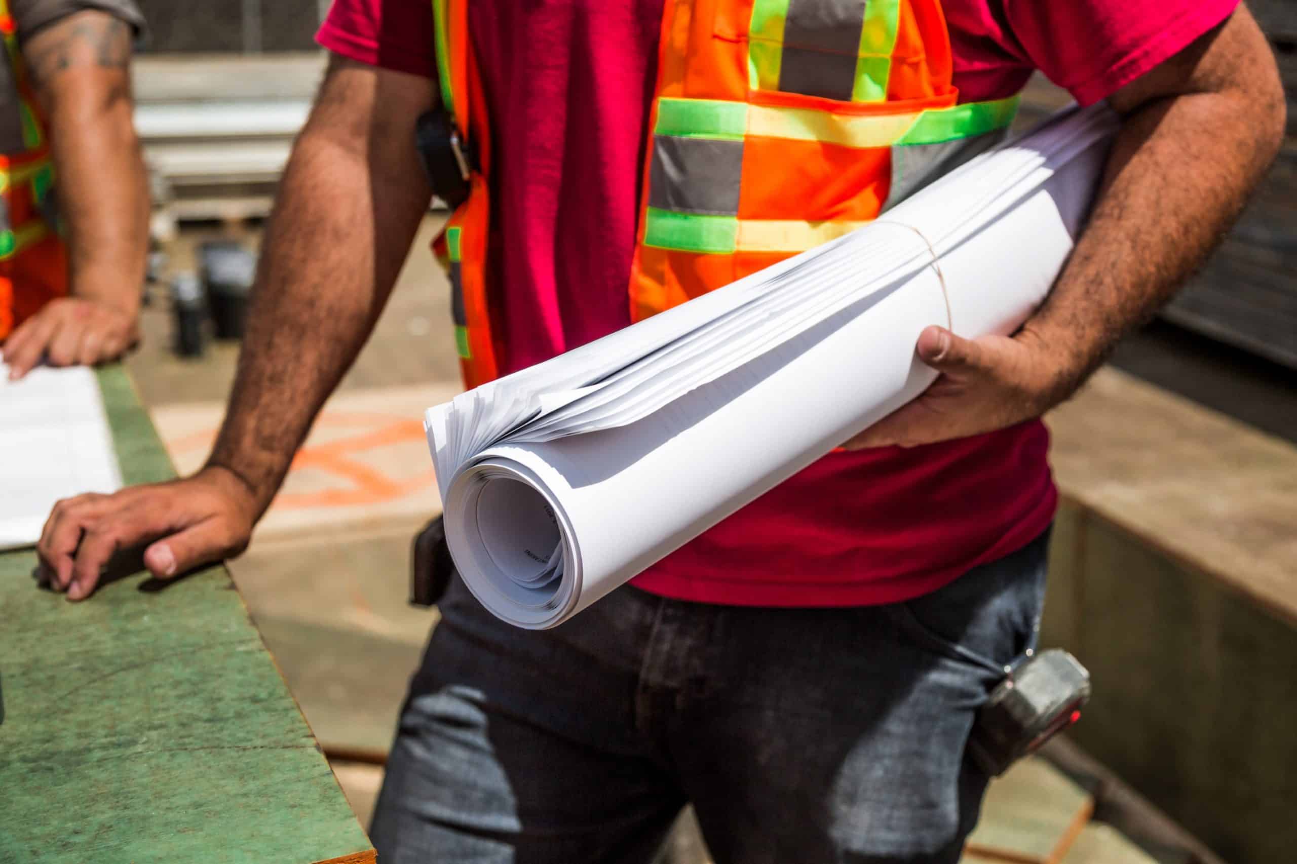
In any industry, workplace safety is of critical importance. Industries where contract workers are hired by authoritative management corporations to complete tasks in dangerous sectors, often find themselves looking at how they can improve safety measures.

As many tasks in these fields require the use of heavy machinery or the movement of large and hazardous items – many are looking at how telematics advancements can help.


Hiring In Dangerous Sectors

To fully understand the need to implement safety measures via telematics, the hiring process must be understood in dangerous sectors such as construction, transportation, forestry or logging and even mining and oil. In these industries, businesses often outsource work by hiring contractors rather than hire full or part-time workers. There are number of reasons why:


Productivity and Finances 

Often in these dangerous sectors, this type of work is seasonal. This means that workers are only required at certain times of the year. Corporations prefer the flexibility of outsourcing work, so they do not have to deal with the administrative challenges of constantly having to layoff workers at the end of each busy season.

Corporations understand the massive financial benefits of outsourcing to contractors. Operations managers discovered that by hiring seasonally, they can perform cost comparisons in terms of productivity and pay for all workers.

They are able to perform such comparisons during the season to monitor and re-hire the best-performing contractors. As a result, corporations can maximize their productivity and revenues, allowing them to remain competitive in an aggressive marketplace.


Reduced Liability  

By outsourcing work and hiring seasonal contractors, many corporations also find that they can improve their liability risk. This enables their business to be more focused on supplying the proper safety requirements, while the actual need to carry out safe work practices are shifted to a  constructor or general contractor who undertakes ownership of the project.

It is important to highlight that corporations will be required to ensure safety in the means of: (i) ensuring proper training is available; (ii) all workers and supervisors are properly trained on safety policies or precautions; (iii) have the appropriate safety tools; or (iv) the proper equipment and safety environment to protect the workers.

This means that the constructor is responsible for ensuring that all workers on site are complying with safety policies, procedures and obligations – or inadvertent liability.


Risk Evaluation and Assessment: Onsite and Offsite 

In sectors where authoritative management governs worksites, the concern of safety does not end there. There are risks when workers are moving supplies or travelling between sites. When risk is evident in numerous locations at varying times, the need to collect and analyze data to evaluate risk becomes even more critical. 


Onsite Risk

Onsite risks are typically limited to the immediate actions of contractors. Often this refers to the knowledge of training and precautionary measures taken by workers while completing tasks. For example, knowing how to safely harvest timber and load lumber into the flatbed of a truck with the use of heavy machinery. When proper training and undamaged tools or equipment is utilized, the onsite risk is significantly lowered.


Offsite Risk

In comparison, offsite risks are factored-in to the immediate actions of contractors – as well as their working environment. As much as offsite risks arise when goods are being transported, contractors must be attentive to their surroundings. A wide range of unpredictable incidents can happen at any job site – including injury, road clean up and even lost resources.

A business can mitigate the risks by having pre-trip checks on the vehicle or implementing tools to ensure that strict safety protocols are being followed.


How Authoritative Management Can Reduce Risks

To properly reduce risk and liability concerns, fleets in these dangerous sectors must investigate risks and assess danger in the field. To better understand current initiatives and procedures, companies must evaluate key historical safety indicators – which will shed light on how efforts may need to change.   

In order to fully understand your current KPIs and solutions framework, a telematics assessment should be performed. It’s important to note that while solutions may have several advantages, it is critical to understand how the solution will specifically target safety.

There are three options that can be implemented in industries that are dangerous or hazardous for its workers.


1 Sensorizing Your Fleet 

Installing sensors throughout your fleet can minimize risk as the devices can act as a safety precaution. Since the technology transmits various data internally, many corporations have found sensors to be useful for the following: displaying real-time GPS location, displaying alerts or notifications and confirming weight or load requirements.

When sensors are installed onto equipment or vehicles, teams can know the exact movement of the asset it is attached to, in addition to certain compliance requirements that may need to be met – such as weight or load. However, one important use to highlight is the alert system for trip inspections, as the sensor can convey whether certain safety precautions are faulty. This means that unsecure lids or caps, loose straps, completed walk around checks or even whether a contractor has the proper training on file to use certain equipment can be detected. 


2 Increased Visibility With Cameras 

Cameras can be installed throughout fleets to monitor the use and performance of vehicles and heavy equipment. Not only can this record the events in view of the device, such as general employee safety on site, but it detects whether contractors are using the equipment properly while moving between two points.

The most important feature of using the cameras, however, is to perform incident reviews when there is an accident, reported issue or complaint of delay. By having footage readily available, site managers are able to review what happened rather than rely on worker or civilian recollection. Meaning proper actions like additional training, suspension, or understanding of liability and fault can happen. 


3 Safety Scoring And Training Integrations 

As previously mentioned, cameras can be used to help shed light on more training opportunities. Specifically, equipment use via engine monitoring and camera surveillance can be used to determine safety scores for each worker. This allows for performance ratings to be completed and even allows for training or site suspension to be assigned based on the person’s skills or knowledge of procedures.


Use Case: Forestry and Logging 

To ensure safety in a high-risk sector like forestry, many authoritative corporations are implementing telematics solutions throughout their operations. Such telematics solutions include the three previously discussed tools: sensors, cameras and scoring or training systems. 

By sensorizing fleets, corporations in logging are able to ensure that certain actions are always taken and even set up alerts to notify workers when certain actions were not taken. This is specific to the loading process on a logging site when lumber is placed on flatbed trucks to move it to the millsite. Since these vehicles are moving thousands of pounds of lumber, if straps are not secure, cargo can find its way off the vehicle while on route. If this happens, regardless of whether it is on public or private roadways, death and injury of a bystander becomes a real concern. 

Fleets that install cameras on vehicles and heavy machinery find that they can better monitor the behaviour of employees – focusing on whether individuals are acting safely by following procedures. This enables companies to flag safety concerns. Such concerns include insecure loads being dispatched or contractors forgoing pre-trip checks. 

Cameras are also useful when offsite vehicles can sometimes be involved in accidents involving civilians, such as accidents with other vehicles or dangerous driving. Verifying what really transpired by reviewing the driver footage can shed light as to what truly happened and who was at fault. It can also provide a resolution framework as incidents are documented and structural changes are made to rectify them

Lastly, all of the information collected on employee behaviour can be reviewed and submitted into a scoring system. Meaning managers can see who is following safety protocols and who may need additional training.

To learn more about how telematics is being used right now, check out our recent success story that features Forest Trotter by clicking here.


Cellular Asset Trackers: Don’t Make The Mistake Of Investing In The Wrong One

There are so many cellular asset trackers in today’s markets for fleet managers, that things can sometimes seem overwhelming. How do you know which hardware you need to buy or how you can get the best value out of it? We will be discussing the different hardware devices for various fleet management needs and the scenarios in which fleets can use each device.


Cellular Asset Trackers? Why Not Satellite Asset Trackers or BLE Beacons?  

When speaking about asset trackers, there are many options available. However, the way they differ from each other initially is based on how the device transmits information. 

  • Cellular asset trackers use cellular network coverage to transmit data and information about an asset. As coverage varies based on specific locations, assets using these trackers that enter no coverage zones will not be able to transmit data.
  • Satellite asset tracker use satellite connectivity to transmit data about an asset and can be the more reliable option if your asset is travelling out of cellular coverage.
  • BLE beacons have pre-requirements (like asset trackers or BLE readers) in order to transmit data and information about an asset or group of assets.


Below we discuss 6 cellular asset trackers that are available, and how their features differ.


6 Top Performing Cellular Asset Trackers 

Flex Solar Asset Tracker 

The Flex Solar Asset Tracker is an asset tracker that syncs with MyGeotab and works similar to a Geotab device as it allows the tracker to be visible on a map. The tracker is solar-powered and is utilized primarily for the general tracking of bulk cargo containers, vehicles and other large assets that may not have a direct power supply – thus requiring solar energy. The ability to power the device through environmental conditions is critical as certain large assets that are travelling far distances or are being stored outside for long periods of time (like shipping containers) are often standalone assets with no power connections. It should be noted that a full charge can allow the Flex tracker to last up to 4 months with multiple pings per day. It’s also important to note that this tracker can be expandable for door sensing, temperature probing and tire pressure tracking.

Use-Case: How Long-Haul Transporters Are Using Flex Solar

The Flex Solar Asset Tracker is praised for its ability to remain powered with solar energy. Meaning, businesses no longer have to worry about removing trackers to replace batteries. Instead, they only rely on the sun to power the device so data about the asset tracker can be transmitted. This is particularly useful for commercial transportation fleets who conduct long-haul deliveries. As the device can continue to charge and transmit information via the sun, the asset tracker can always send real-time data. Typically, this solar power feature is praised by those who enjoy a ‘set-it and forget-it’ device, or for those who are looking to take advantage of renewable and free sources of energy.


Blackberry Radar

The Blackberry Radar device focuses on asset tracking for cargo, more specifically, for vehicles and non-motorized assets like bulk containers, trailers and various equipment where content quantity needs to be monitored. The tracker is unique as it requires a specific installation to allow for its radar feature (which analyzes the quantity of cargo within a container or trailer) to be used. Once the device has been placed at the predefined orientation, it can analyze the content capacity of the asset it is attached to. This is explained as acting like a camera that measures how much cargo is present. Having a radar function like this is new and allows for users to complete better planning as there are more accurate (and visual) load-stats available.

Use-Case: How Delivery Vehicles Are Using Blackberry Radar 

As previously mentioned, the Blackberry Radar tracker allows for radar sensing and load analysis of the quantity of content within an asset. Meaning, users can see exactly how much is within a trailer, truck or container in real-time. This radar tracker is particularly useful in delivery fleets who constantly receive new delivery requests. Using this tracker allows dispatchers to analyze and review the content quantity of each delivery vehicle. Essentially judging which vehicles are full and whether near-empty vehicles have enough space to pick up additional deliveries to complete that day.


Remora2

The Remora2 tracker is utilized for general asset monitoring and has expandability opportunities with BLE beacons. As the tracker uses a Bluetooth 5.0 gateway, which allows it to communicate with other local asset tags to report on them, it is the ideal investment if you will later need to invest in various BLE beacons. As a standalone device, this tracker is similar to the Flex tracker that was mentioned previously as it allows for general location tracking. However, what differentiates itself from the Flex Solar tracker is that it has an ion battery. Meaning, depending on where an asset will be stored or used most of the time, having a battery option may be the more powerful and reliable choice. As well, when compared to the Solar Flex, it’s important to mention that it is the cheaper option as there is no solar-power technology required. It is also important to note that the Remora2 device has an anti-theft mode, tamper detection, is geo-fence aware, and functions as a 3rd party device on MyGeotab.

Use-Case: How Commercial Transportation Fleets Are Using Remora2

Similar to the Solar Flex tracker, the Remora2 tracker is typically used within fleets who are conducting long-haul deliveries that require more pings daily or are spending some time in a location where solar changing is difficult. Meaning, having an ion battery rather than a solar-powered battery would be the more reliable option to suffice reporting needs. 


Falcon 

The Falcon device is a temperature-sensitive tracker which allows for fleets to monitor temperature and humidity. The device embodies a 5-year battery life with hourly reporting so users have continuous monitoring of temperature-sensitive cargo. Similar to the Remora2 device, the Falcon device has an anti-theft mode, tamper detection, is geo-fence aware, and functions as a 3rd party device on MyGeotab. 

Use-Case: How Food Transporters Are Using Falcon 

When tracking goods that are sensitive to temperature and humidity, the Falcon is the go-to tracker for many fleets. Since the device focuses on allowing users to monitor the environmental conditions of containers, trailers, trucks and more, it’s the perfect tool to use when moving food products. As improper storage is not an option for food products as it can lead to spoilage, the Falcon tracker can monitor the temperature and humidity of the location where food products are stored to ensure that conditions meet strict regulations. Forgoing a device like the Falcon leaves food transporters at risk for being found incompliant as there are numerous rules  regarding the proper storage and handling of frozen food, fresh produce and meat products to keep consumers safe. 

advantages-temperature-monitoring


Sensoneo Bin Fill Level Sensors

Sensoneo Bin Fill Level Sensors are a smart, enterprise-grade waste management solution that focuses on monitoring waste content quantity. The sensor is a robust device that can withstand harsh conditions such as water and is shock resistant which is perfect for its use in waste management. Sensoneo focuses on allowing fleets to remain efficient and optimized as it monitors how full a waste bin is, alerting users when the bin is approaching capacity. Additional features of the device include; Bluetooth, pick-up recognition, temperature measurements, fire alarms, and overturn alarm options. 

Use-Case: How Waste Disposal Fleets Are using Sensoneo 

Sensoneo is leveraged by waste disposal fleets who empty waste bins. Typically, the device is attached to a specific bin to monitor how full the container is getting overtime, alerting users of when it is near-full and needs to be emptied. When the tracker sends an alert about the quantity level, fleets can create a route that only visits the bins that are full or are at least 80% full – passing bins that are less. Doing this helps to ensure that time is not wasted visiting bins that do not need to be emptied so work is optimized and resources can be saved. 


A Cellular Asset Tracker Cheat-Sheet

When it comes to cellular asset trackers, there are numerous devices available that any business can use and sometimes, their features can become confusing. To help businesses better understand what their cellular tracker options are, we created a feature comparison chart below based on our analysis above.

Still unsure about what cellular tracking device may work best for you, or would like to learn more about a specific tracker? Contact us today so we can set up a time to chat about your unique needs. 

COVID-19 Recovery: Why Your Vehicle Data Is More Essential Now

The past few months have been an unsettling time for many workplaces as the COVID-19 pandemic has drastically affected businesses. Since this global pandemic started, Geotab recorded and reported on datasets to help fleets better understand the current landscape. As we are on the road to recovery, it is important for businesses to review how the commercial transportation sector is performing in relation to their own performance. Reviewing industry trends alongside personal vehicle data can allow fleets to make actionable decisions moving forward. 

Below we use Geotab specific data that was updated on May 29, 2020, to help our readers better understand current commercial transportation activity, industry-specific activity, and fuel fill-up activity in relation to their operations. 


Commercial Transportation Activity: A Slow Increase 

With a baseline of February 2020 being used, it is clear to see in the image below that in comparison to the lowest dips in April 2020 (when many cities were in peak-response to COVID-19), there is a slow increase happening across the world. This is seen specifically in Canada, the United States, the United Kingdom and Australia. While there appears to be a rise and dip effect occurring, many view it to be a good sign that the dip does not last for long, as well that the rises are gradually increasing. 

Source: Geotab 

When speaking about the future, many believe that when businesses begin to reopen, their activity will drastically affect this graph. It is predicted that with more businesses reopening and requiring more inventory, stock or supplies, more vehicle use will occur. 


Industry Vehicle Activity: What Is Happening During The COVID-19 Recovery


While the above graph may show positive signs that vehicle traffic is increasing, it’s important to note that it is not the case for all industries. Since February 2020, there are a number of industries where vehicle activity has not recovered as much as others in North America. These industries include non-freight transportation, healthcare services and business services. Many account this lack of recovery to be due to many unique businesses not reopening, or being unable to reopen to full-productivity. An example where this is visible is in the public transportation sector which has seen a continual decrease in activity as public transportation use is low (possibility as a result of the public not commuting to work as they are working from home). 

Source: Geotab 

Some industries to highlight that are steadily increasing are construction, government, freight transportation, retail and telecommunications. This slow increase is typically due to the reopening of many businesses that could no longer hold off operations and were approved by governments to slowly reopen. For example, within the construction industry, the longer work was paused, the longer the delays for construction to be completed. When speaking about condo developments or other development projects, many companies could not financially afford to hold off construction due to financial and contractual responsibilities to home buyers. 


Fuel Fill-Up Activity: What Increases Can Mean 

In North American the vehicle telematics data gathered by Geotab confirms that fuel fill-ups of varying larger-sized vehicles are increasing. The data shows that since the end of April, there has been a noticeable increase in the usage of LDT (light duty trucks) and MDT (medium duty trucks) vehicles. This is likely in accordance with traffic increases for industries who are looking to resume operations. It is important to note however, that there are some vehicles such as MPV (multi purpose vehicle), passenger and bus that may not see such increases in fuel fill-ups until there are less restrictions on public contact and public outings. The steady increase in varying industries is important to monitor because it allows for vehicle-based businesses to see how their specific industry is performing overall. 

Source: Geotab 


What Your Vehicle Data Means 

Properly Collecting Data 

With all of this information available, it’s important for businesses to use it to their advantage. Specifically, by reviewing the vehicle telematics data of their own business in accordance with industry competitors. By using telematics solutions businesses are able to review current operations and see whether their organization is on par with industry trends.


Collecting Your Own Data 

In order for businesses to truly see results from the data gathered by Geotab, there must be processes in place to collect information related to their fleet. If no solutions are currently in place, or businesses are unsure about what should be used, the first step is to use a GPS tracking device like the GO9. For the purpose of this discussion, the GO9 can be used to record the GPS location of vehicles and depict usage within detailed reports. As well, it allows for easy add-on hardware through an IOX expansion port to allow for future tracking of HOS ELD, auxiliary, temperature monitoring as well as other third party monitoring solutions.


An additional tool to use to properly measure against the industry trends mentioned above, is to implement a fuel card integration. Using a tool like FuelBi allows fleets to better track the fuel fill-ups of company vehicles. While the device initially focuses on tracking and visualizing important fuel KPI’s and transactions, it is also used to monitor how frequently company vehicles are being filled. This directly shows the usage of company vehicles.


Comparing Company Data To Industry Data

When businesses reach the point that they have accumulated enough data to properly view how their fleet is performing, it can then be compared to the industry trends above. After reviewing the data in accordance to current industry trends, business owners and managers are encouraged to adjust their operations accordingly. What this means is that if businesses see that they are performing at a lower rate than their industry, they need to research why. Sometimes a lack of operational customers or possibly a decrease in availability of your team are the answers. As there are various reasons for why your business may not be recovering from the COVID-19 pandemic at the same rate as competitors, it’s important to work with professionals who can point out why this may be happening and offer solutions that drive results. 

Interested in working with a team who can help? Contact GoFleet today. Our team is experienced in data analyzation and consultation as our goal is to have every customer outperform their competitors. 

Is Your Commercial Contracting Business Maximizing Its Telematics Potential?

When it comes to moving a business forward, many look to implement new tools and strategies to accommodate changing processes and requirements. Recently, the focus for organizations is to streamline processes to not only ensure accuracy and employees responsibilities, but to boost finances. Within the commercial contracting field, telematics can accomplish this and more, specifically with the implementation of new and powerful management systems.


What Are Management Systems

A management system is a telematics solution that is used by numerous business owners and managers to grow their business and achieve their long term goals. Not only can these systems work to increase workflow, but these systems also allow for expandability while keeping costs low or reducing them even further. Although the features of management systems can vary, typically solutions can be adjusted to allow for custom mapping or GPS features, dispatching, maintenance, visibility and tracking. The focus is usually streamlining and automating data collection, complying to rules and regulations, as well as streamlining processes. Even though management systems can be applied to nearly any industry in one way or another, one industry that is seeing great potential from using it is commercial contracting or construction. 


Why Commercial Contracting Businesses Are Seeing Success

Increased Visibility 

Management systems are praised for visibility. When speaking about commercial contracting businesses, visibility from solutions allows managers to better supervise their teams, resulting in greater management of the overall business. 

For example, since management systems offer live vehicle tracking and equipment tracking integrations, the location of employees and available equipment are always known. So when a call comes in, a dispatching manager can properly dispatch the closest worker who has the right training. Or, managers can dispatch the employee who has the proper tools and equipment, ensuring that they are maximizing their teams efforts by sending someone who can complete the job.


Less Downtime 

In addition to live gps fleet tracking, these systems are able to conduct maintenance monitoring for connected vehicles so companies face less downtime and gain larger profits. Not only is this apparent in regards to deploying efforts (as the system will ensure that the right employee with the right skills or equipment will arrive), but in regards to asset quality. This concept speaks to the monitoring of tools, equipment and even the vehicles themselves to ensure they are in peak working performance. As management systems gather specific data that is applied to predetermined algorithms, it is possible to learn when to schedule maintenance.

For example, sensors and diagnostic devices can be installed to monitor vehicle performance. Prompting managers to determine when maintenance should be scheduled. This allows teams to stay productive as sudden breakdowns that cause vehicle downtime happen less often.


Boosted Safety 

Lastly, depending on the nature of your commercial contracting business, you may find that your team is frequently dispatched to rural job sites alone. With management systems, managers are able to integrate a number of safety solutions to better protect their lone workers. One to highlight is the Man Down System which offers remote location management. This is through the increased communication from a device that can sense when a worker is injured or falls, resulting in a triggered motion sensor and thus, transmitting a notification requesting the assistance of management and EMS services. 

Regardless of what your focus is for 2020, a management system is a tool that countless contracting businesses are seeing benefits from. Not only are managers and owners noticing that they are able to have more visibility on their team, but they can find ways to integrate maintenance and safety features. 

If you’re interested in learning more about the management features that are available, or what integrations could best fit your unique business needs, contact us today! We’ll be happy to speak with you to learn exactly what you may want to invest in so you can see success in the new year!