Fleet Safety

The Impact of Fleet Tracker GPS on Accident Reduction

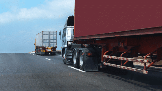
Fleet safety stands as a crucial concern that directly affects both operational efficiency and the well-being of drivers and the public. Businesses that disregard the importance of adhering to fleet safety regulations expose themselves to substantial financial, legal, and reputation-related repercussions. In this context, Fleet Tracker GPS systems have assumed a paramount role. 

Citing a report by the Occupational Safety and Health Administration, the financial toll of a fleet vehicle accident can range from $16,500 to $500,000 for a business, contingent on the extent of injuries and property damage. Collectively, motor vehicle collisions result in a staggering $60 billion annual burden on employers, encompassing lost productivity, medical expenses, property harm, and legal outlays.

The implications of accidents involving fleet vehicles go beyond mere financial setbacks, extending to brand reputation, legal liabilities, and, most importantly, human lives. As such, the integration of advanced technologies has emerged as a pivotal strategy for reducing accidents and promoting overall road safety.

Fleet tracker GPS technology offers a comprehensive solution to the challenges of fleet management and safety enhancement. By providing real-time insights into vehicle locations, routes, and driver behaviors, Fleet Tracker GPS has the potential to revolutionize the way fleets are managed, monitored, and optimized for safety. 

In this article, we delve into the transformative impact of Fleet Tracker GPS systems on accident reduction within fleet operations, highlighting their features, benefits, and implications for businesses and road safety.

Real-time Monitoring for Preventive Measures

One of the cornerstones of Fleet Tracker GPS systems is their ability to offer real-time vehicle tracking. With these systems in place, fleet managers gain an unprecedented level of visibility into their vehicles’ exact locations and movements at any given moment. This real-time monitoring goes beyond the traditional approach of retrospective analysis; it empowers fleet managers to proactively respond to potential safety risks before they escalate into accidents.

Tracking vehicles to prevent accidents

By tracking vehicles in real time, Fleet Tracker GPS enables the early identification of risky driving behaviors. Speeding, harsh braking, sudden lane changes – all these actions can be immediately flagged and reported. This data not only assists in pinpointing potentially dangerous behaviors but also lays the groundwork for a comprehensive analysis of driver habits. Identifying these behaviors in real time offers the advantage of timely intervention – managers can promptly reach out to drivers, provide feedback, and offer guidance to curb unsafe actions.

The significance of such proactive interventions cannot be overstated. Rather than relying solely on post-incident analysis, Fleet Tracker GPS allows for a dynamic, preventative approach to safety. By addressing issues in their infancy, fleet managers can work collaboratively with drivers to rectify behavior patterns, mitigate risks, and ultimately decrease the likelihood of accidents. This real-time monitoring thus functions as a crucial tool for fostering a safety-first culture within the fleet and establishing a foundation for accident reduction.

Driver Behavior Analysis

One of the cornerstones anchoring Fleet Tracker GPS systems is their remarkable capacity to offer real-time vehicle tracking. These systems imbue fleet managers with an unparalleled level of visibility, enabling them to ascertain their vehicles’ precise locations and movements at any given moment. This dynamic form of real-time monitoring transcends the traditional realm of retrospective analysis, elevating fleet management to a proactive realm where potential safety risks can be promptly addressed before they have the chance to evolve into full-fledged accidents.

Through the continuous tracking of vehicles in real time, Fleet Tracker GPS systems open the door to early identification of risky driving behaviors. Instances of speeding, harsh braking, abrupt lane changes – these actions are instantaneously identified and brought to attention. Yet, the utility of this data extends beyond mere identification, forming the foundation for a comprehensive analysis of driver habits. The ability to recognize these behaviors in real time lends itself to timely interventions. Fleet managers can promptly engage with drivers, deliver constructive feedback, and provide guidance to temper unsafe actions.

Fleet Tracker GPS introduces a dynamic, preventive dimension to safety management, deviating from the traditional reactive stance. By addressing emerging issues at their inception, fleet managers forge collaborative relationships with drivers to rectify behavior patterns, curtail risks, and ultimately curbing the probability of accidents. This real-time monitoring, therefore, emerges as a pivotal tool, not only in enhancing fleet safety but in nurturing a culture deeply rooted in safety consciousness, thereby laying the cornerstone for a marked reduction in accidents.

Geo-fencing and Route Optimization

Beyond real-time monitoring, Fleet Tracker GPS systems offer another layer of safety enhancement through features like geo-fencing and route optimization. These functionalities not only contribute to efficient fleet operations but also play a pivotal role in accident reduction.

Geo-fencing is a standout capability that enables fleet managers to establish virtual boundaries and designated safe zones on digital maps. This means that specific geographical areas can be defined, such as customer locations or high-risk zones, within which vehicles are expected to operate. 

When a vehicle equipped with Fleet Tracker GPS crosses these predefined boundaries or enters/leaves safe zones, the system promptly triggers alerts. This immediate notification empowers fleet managers to take prompt action if deviations occur. Whether it’s monitoring unauthorized detours or ensuring vehicles adhere to safer routes, geo-fencing acts as a proactive measure that contributes significantly to accident prevention.

Furthermore, Fleet Tracker GPS excels in route optimization, a feature that holds the potential to reshape how fleets navigate roads. By analyzing real-time traffic data and considering factors like road conditions and congestion, these systems generate the most efficient routes for vehicles. Optimized routes not only save time and fuel costs but also decrease the likelihood of accidents. 

By reducing exposure to congested or accident-prone areas, fleet vehicles are less likely to encounter potentially hazardous situations. The technology’s ability to dynamically reroute vehicles based on changing conditions demonstrates its capacity to lower risks and contribute to accident reduction.

In essence, the integration of geo-fencing and route optimization within Fleet Tracker GPS systems signifies a proactive approach to safety management. These features empower fleet managers to uphold stringent control over vehicle movements, ensuring adherence to predetermined routes and designated safe areas. Such control fosters an environment where the risk of accidents is significantly curtailed, aligning with the overarching goal of establishing a safer and more secure fleet operation.

Maintenance and Safety Reminders

In the pursuit of comprehensive fleet safety, Fleet Tracker GPS systems extend their influence beyond real-time monitoring and route optimization. They also contribute to accident reduction through the integration of maintenance schedules and proactive safety reminders.

The integration of Fleet Tracker GPS with maintenance schedules brings a transformative dimension to fleet management. These systems allow fleet managers to synchronize maintenance tasks with vehicle usage patterns and real-time data. By intelligently monitoring factors like mileage, engine hours, and usage conditions, the system can proactively alert managers when vehicles are due for maintenance. 

Regular maintenance is a cornerstone of accident prevention. A well-maintained vehicle is less likely to suffer from sudden breakdowns or mechanical failures, mitigating the risk of accidents caused by unexpected malfunctions. This integration, therefore, creates a proactive maintenance regime that significantly enhances fleet safety and contributes to overall accident reduction.

Moreover, Fleet Tracker GPS can actively engage with drivers by sending safety reminders and guidelines directly to their consoles. These reminders serve as ongoing cues for safe driving practices, promoting adherence to speed limits, cautious braking, and responsible lane changes. By keeping safety at the forefront of drivers’ minds during their journeys, the system contributes to a culture of vigilance and responsible driving. This real-time reinforcement of safety practices adds an extra layer of protection against potential accidents, ultimately aiding in accident reduction.

The amalgamation of maintenance scheduling and safety reminders within Fleet Tracker GPS systems represents a holistic approach to fleet safety. By ensuring vehicles are well-maintained and drivers consistently practice safe behaviors, these systems foster an environment where the risk of accidents is actively minimized. This approach aligns with the overarching goal of creating a secure and reliable fleet operation that prioritizes both driver and public safety.

Incident Reconstruction and Investigations

The value of Fleet Tracker GPS systems extends beyond accident prevention, encompassing incident reconstruction and thorough investigations. The rich data captured by these systems plays a pivotal role in understanding and dissecting accidents when they do occur.

Fleet Tracker GPS data serves as a virtual eyewitness during accident reconstruction. The system records crucial information such as vehicle speed, location, direction, and braking patterns leading up to the incident. This data proves invaluable in deciphering the sequence of events that led to the accident, aiding investigators, law enforcement, and insurance professionals in recreating a precise timeline of the event. Accurate accident reconstruction lays the foundation for identifying contributing factors and potential liabilities, forming the basis for informed decision-making and corrective measures.

In investigations following accidents, Fleet Tracker GPS data can be a game-changer in establishing liability. With a clear record of vehicle movements and behaviors, it becomes easier to determine whether a driver complied with traffic rules and exercised due diligence. This data can exonerate innocent drivers or reveal negligent actions, providing an objective basis for attributing fault. Consequently, this technology not only accelerates investigations but also supports fair and just outcomes.

Furthermore, the data collected by Fleet Tracker GPS systems can streamline the insurance claims and litigation processes. Accurate data substantiates claims, preventing fraudulent or exaggerated assertions. Insurance companies can access detailed insights into the circumstances of the accident, facilitating quicker and more accurate claim assessments. In litigation scenarios, the availability of comprehensive GPS data can either expedite settlements or provide compelling evidence in court proceedings, potentially reducing legal complexities and associated costs.

In essence, Fleet Tracker GPS systems contribute to the post-accident landscape by offering a wealth of data that aids in understanding, determining liability, and navigating insurance and legal procedures. This capability adds a layer of transparency and objectivity to accident investigations, ultimately promoting fair outcomes and supporting the broader goal of reducing the frequency and severity of accidents within fleet operations.

Driver Training and Accountability

The data harvested from these systems provides a treasure trove of insights that fuel effective driver training programs. Fleet managers can analyze individual driver behaviors, identifying patterns of risky actions such as sudden accelerations, harsh braking, or abrupt lane changes. 

Driver training

Armed with this granular data, training programs can be tailored to address specific areas of improvement for each driver. Data-driven coaching allows for targeted interventions that resonate with drivers, helping them recognize unsafe habits and offering practical guidance to rectify them. This personalized approach enhances the efficacy of training initiatives, resulting in more engaged and responsible drivers.

Driver accountability receives a substantial boost through data-driven feedback as well. Fleet Tracker GPS provides concrete evidence of driving behaviors, making discussions about unsafe actions more objective and less subjective. When drivers are aware that their actions are being accurately recorded, they are more likely to exercise caution and adopt safer driving practices. 

This accountability loop creates a sense of responsibility where drivers actively strive to improve their behavior, knowing that their actions have a direct impact on their own safety and the safety of others on the road.

The continuous improvement cycle spurred by Fleet Tracker GPS data cultivates a safer and more responsible fleet environment. As drivers receive ongoing feedback and training, they become attuned to safe driving principles and the repercussions of deviating from them. 

This proactive approach nurtures a culture of learning, accountability, and self-assessment that ultimately leads to safer driving habits across the fleet. Through this process, Fleet Tracker GPS becomes not only a technology tool but a driver development partner that contributes to a safer and more responsible fleet operation.

Case Studies

Real-world success stories underscore the tangible impact of Fleet Tracker GPS systems on accident reduction and business performance. Let’s explore a few examples that highlight the transformative power of this technology.

Case Study 1: C&C Group Enhances Fleet Management Through Telematics

C&C Construction Group

The Challenge: Enhancing Visibility and Safety

  • In 2015, C&C Group, a family-owned construction services company operating in Kansas and Missouri, faced a significant challenge. With a growing fleet of 75 pickups and vans over the past 40 years, the company lacked comprehensive visibility into their vehicle operations. This lack of oversight extended to their employees’ driving behaviors and safety practices.
  • The safety of employees, who were more like extended family members, became a paramount concern after an incident involving the owner’s daughter. This incident, though unrelated to the business, highlighted the need to safeguard their team while they were on the road. The company allowed employees to take vehicles home overnight, making it crucial to ensure responsible driving practices and minimize risks.

The Solution: Embracing Telematics for Safety and Efficiency

  • To address these challenges, C&C Group turned to vehicle telematics. Chad Cillessen, the Chief Information Officer, recognized that telematics could provide the visibility and insights needed to enhance safety, monitor driver behaviors, and optimize vehicle usage. Geotab telematics was selected to improve the company’s safety measures and overall operational efficiency.

Addressing Safety Concerns and Claims

  • C&C Group’s proactive approach to safety included monitoring seat belt usage and identifying other key safety issues through the telematics system. Telematics allowed the company to verify the accuracy of accident complaints from other drivers by providing concrete data on vehicle locations and behaviors. This capability enabled the company to swiftly resolve disputes and protect themselves from false claims.

More Than Just Numbers

  • The benefits of telematics extended beyond safety. C&C Group discovered additional advantages, such as tracking fuel consumption, minimizing idling time, and improving maintenance practices. With real-time data insights, the company gained a better understanding of fuel consumption trends, driver behavior, and average miles per gallon.

The Results: Efficiency and Environmental Impact

  • By utilizing telematics, C&C Group enhanced its fuel consumption tracking accuracy. The company could now cross-reference driver-inputted fuel consumption data with system-generated reports, leading to more informed decisions. The data-driven insights empowered the company to improve idling habits, leading to significant cost savings and a positive environmental impact.

Continued Progress and Future Prospects

  • C&C Group’s success with Geotab telematics showcased the value of data-driven insights in enhancing safety and operational efficiency. The company’s forward-looking approach also extended to utilizing telematics for maintenance management and carbon emissions tracking.
  • Mr. Cillessen cautioned about data overload and emphasized the importance of a partner like Geotab in making sense of the data for effective decision-making. C&C Group’s journey with telematics exemplifies the transformational benefits that technology can bring to fleet management, safety, and environmental responsibility.

Case Study: Elevating Efficiency and Safety at Red Hawk Fire & Security (Conducted by Geotab)

Red Hawk

  • Across North America, over 50,000 enterprises and institutions rely on Red Hawk Fire & Security’s expertise and resources. The company specializes in delivering advanced safety and security technologies, meticulously tailored to cater to the unique requirements of their diverse clientele. On a corporate level, Red Hawk Fire & Security aimed to achieve higher operational efficiency by servicing more customers daily, transitioning from 4 to 5 service tickets. 
  • Concurrently, they aimed to bolster employee productivity and customer satisfaction. Additionally, recognizing the significance of driver behavior in reducing accident rates, the company sought to enhance their safety measures. Addressing their fleet manager’s observations, “We had a considerably high accident rate, particularly in our Northeast Region, which necessitated rectification.” Beyond safety enhancements, Red Hawk Fire & Security sought to minimize fuel consumption and expenditures by effectively managing idle times.

Results and ROI: Achieving Operational Triumphs

  • After an extensive search for a telematics solution that could address both immediate challenges and accommodate future requirements, Red Hawk Fire & Security opted for Geotab. Approximately 400 out of their 800 vehicles were equipped with Geotab’s GO™ device, offering comprehensive insights into each vehicle’s performance through the user-friendly MyGeotab™ web-based fleet management software.
  • The effects of this strategic adoption were profound. Ticket times experienced significant improvements, and even after a year, the commitment to collaborative work with dispatchers continues, aiming for enhanced effectiveness. A surprising advantage, highlighted by the fleet manager, was the revelation during timesheet audits. The technology exposed instances where employees falsely reported full-day work while leaving after just a few hours. This revelation not only eliminated unnecessary overhead costs but also addressed issues concerning employee integrity.

Revolutionizing Safety and Accountability

  • In the realm of safety, Red Hawk Fire & Security achieved an impressive 80% reduction in accidents within the Northwest Region. This achievement stemmed from two core strategies: the monitoring of risky driver behaviors and the subsequent implementation of corrective actions. As a result, the Northwest Region’s accident rate now matches or surpasses other regions’ safety levels.
  • Continued opportunities for improvement remain, particularly in the context of those managers and sales employees lacking telematics devices in their vehicles. Building on their current successes, Red Hawk Fire & Security plans to expand telematics coverage to encompass all remaining vehicles.
  • Additionally, the company accomplished a significant improvement in seatbelt usage. A proactive approach saw over 250 incidents of vehicles in motion without seatbelts fastened on the first day. Within a week of persistent efforts, all employees complied with seatbelt usage.

Charting a Forward Course

  • Red Hawk Fire & Security’s journey of utilizing telematics technology exemplifies how strategic implementation leads to tangible operational advancements. Through meticulous data-driven insights and focused interventions, the company elevated not only its efficiency and safety measures but also fostered a culture of honesty and accountability. 
  • The remarkable results achieved by Red Hawk Fire & Security offer a compelling testament to the transformative power of fleet management technology, encouraging other businesses to explore similar strategies to improve their own operations.

Final Thoughts

The journey through the impact of Fleet Tracker GPS systems on accident reduction unveils a powerful arsenal of tools that redefine fleet safety management. By harnessing real-time monitoring, geo-fencing, route optimization, incident reconstruction, and driver accountability, these systems offer a multi-faceted approach to safeguarding lives, assets, and reputations. The benefits are profound and far-reaching.

Prioritizing fleet safety is not merely a choice, but a necessity in the modern business landscape. Accidents not only bring about financial setbacks but can tarnish a company’s brand and integrity. As seen in the case studies, the integration of Fleet Tracker GPS systems translates to substantial accident reduction percentages, yielding substantial cost savings, fostering a safety-conscious culture, and opening doors to new business opportunities.

To businesses large and small, the message is clear: the adoption of Fleet Tracker GPS solutions is an investment in safety and success. Embrace the transformative power of technology to reshape the way your fleet operates. Now is the time to take the first step towards safer roads, responsible driving practices, and a more secure future for both your business and the communities it serves.

Take charge of your fleet’s destiny – explore the world of Fleet Tracker GPS solutions today and embark on a journey toward safer roads, greater efficiency, and lasting success. Your fleet, your drivers, and your business deserve nothing less.

Unlock the full potential of your fleet with GoFleet’s Fleet Tracker GPS and our advanced management tools! Experience seamless operations, optimize efficiency, and gain total control. Try it now!

GPS Tracking GoFleet

GPS In The Spotlight

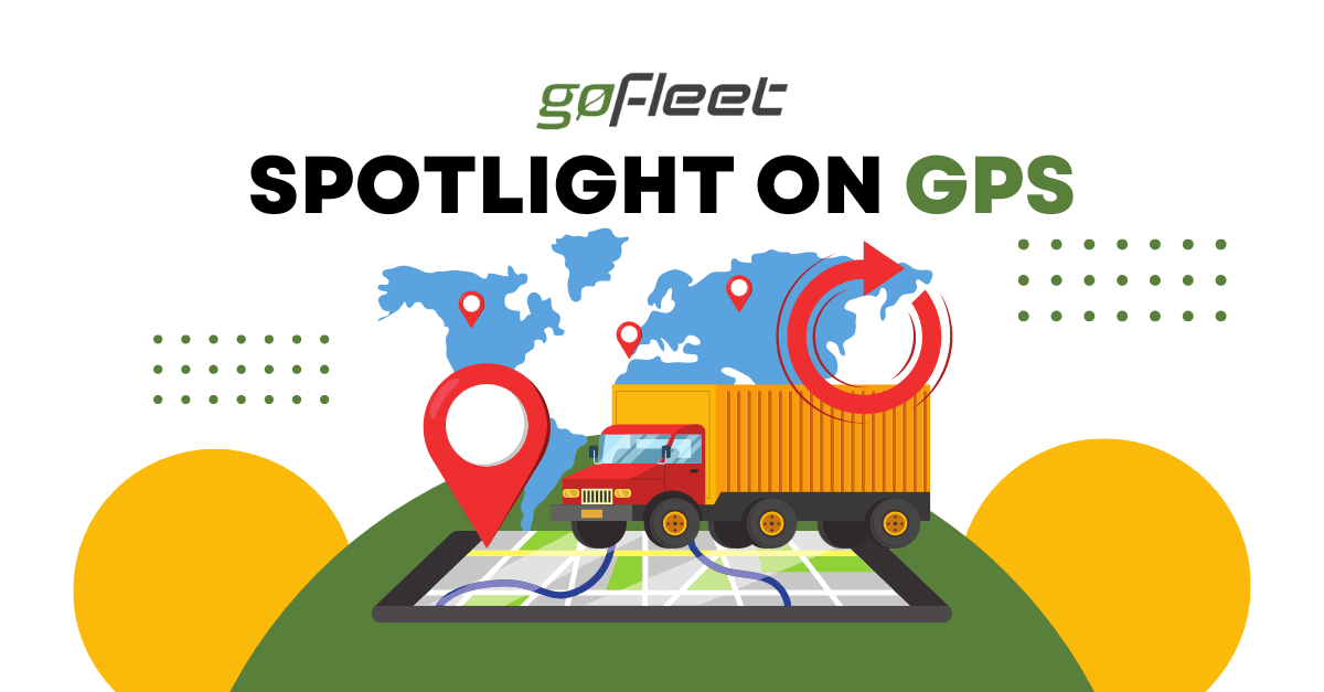
Vehicle tracking and fleet management systems, in its most basic form, help dispatchers, supervisors and managers track the positions of their assets in real time using global positioning systems (GPS). Like a lot of other modern day technologies, it is easy to simply take advantage of how truly extraordinary these everyday instruments are.

Intro to GPS Technology

GPS technology, in short, works when signals are sent from a satellite network that orbit the earth in its atmosphere to your GPS device situated on, or close to, the Earth’s surface. These signals are read and interpreted by the receiver, which then provides you with your relative location.

A standard GPS receiver must have the ability to detect broadcasts from a minimum of four satellites to calculate your position:

  • Three of the satellites are used for determining your position
  • The fourth is used as validation in the event that the other three happen to produce inconsistent data

The time it takes for each signal to reach the receiver is used to calculate the distance of the receiver from the satellites.
This data is used to determine your:

  • Longitude & latitude accurate within about three meters
  • Altitude
  • Velocity
  • Synchronized time

Factors That Can Impact GPS Performance

On the spectrum of signals, signal strength is considered to be relatively weak. This means that your GPS can be affected by certain factors that are uncontrollable. Here are some situations in which performance of your receiver may be compromised:

  • There are poor weather conditions, such as heavy precipitation or dense clouds
  • The receiver is in an environment where physical obstructions, such as deep valleys, mountains, bridges, overhangs, tall buildings or tunnels are apparent
  • The receiver is blocked by something within the vehicle

Understanding GPS Jamming

To address the last point about local interference, also known as jamming, it is important to note that GoFleet’s Geotab GO6 device and other newer models have the ability to detect the occurrence of local GPS jamming. In the case that local jamming does occur, the modem will report a “debug log” which can be found in the Log Details within MyGeotab: “GPSJammingDetected”.

If you find that your device does not have the ability to track your vehicle accurately, you will want to check for any instances of this debug log being reported. If it has been reported, you will be able to begin to identify what could be causing the GPS jamming.

In certain trucks, some metal components in the steering column can interfere with the GPS signal. In other vehicles, such as limos, the signal may be obstructed by a special metallic coating on the windshield that is not visible to the eye.

It isn’t always easy to determine what is causing the jamming. For example, some of the newer models of Hino trucks use a certain Jensen radio system, that includes a CD laser reader that has been previously proven to obstruct the signals.

If you cannot determine what is jamming your signal, contact GoFleet and we will be happy to assist you in identifying the possible causes and suggest resolutions.

Original Article Written by: Jason Widla, Technical Support Engineer at Geotab
http://www.geotab.com/blog/gps-spotlight/

school bus, fleet, gofleet, fleet management, school, back to school, bus eta, telematics

Spotlight on Telematics, Bus ETA and Back to School: A Conversation with Kemal Leslie

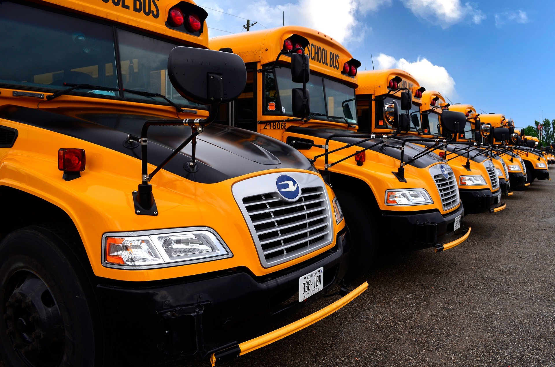
Kemal Leslie, a strategic consultant to GoFleet, talks about Lord Selkirk School Division’s biggest pain points, and how GoFleet’s comprehensive and integrated telematics solutions solved some of their biggest back to school issues.


Tell me a bit about LSSD and the kinds of things they were looking for.


KL: They began working with GoFleet a few years ago to help them manage their bus fleet maintenance and location tracking. This also included management of driver operational safety. 


How did Bus ETA factor into the equation?


KL: At that time, they were also looking at Bus ETA as a solution, where a student or parent of a student, for example, could know when the bus is on its way to pick up or drop off, as well as the whereabouts of that vehicle. This has become a more popular solution over the last, I would say, five or six years, where parents or students want to know when to arrive at the bus stop. 


So it seems that Bus ETA also offers peace of mind?


KL: Well, for safety and security reasons, they received feedback that parents want to be able to track kids’ travel to and from school. They wanted an easy way to oversee their safety. That’s what the Bus ETA application really was about.  


What were the other components of your proposal?


KL: At that time, GoFleet implemented not only their bus tracking and status reports, but had also integrated another solution called On Command Connection with their Geotab telematics system, which is a diagnostic maintenance offering under Navistar. Their maintenance provider can track their buses and advise if any need to be repaired based on automated scheduling and alerts from real-time vehicle data; their maintenance team can call in a repair just by looking at the status report that’s provided through On Command.

Finally, Transfinder became the next third party integration for this solution. It’s a mobile application that tracks where the student is; if they are on the bus, when the bus is arriving, that type of thing. The system actually utilizes Geotab telematics data to manage the reporting within the application where the student might be at any given time, or where the bus is in terms of its daily trips.


So in terms of the evolution, it started as a fleet management application to manage the hardware, the equipment, location status, etc. And then student tracking for parents was integrated to centralize everything within their GoFleet solution.


That sounds really comprehensive. What are some other applications for this system outside of LSSD?


KL: Well, the entire solution could serve many verticals really, either in part or as a whole integrated solution. The fleet management piece can apply to any industry that requires management of their own automated fleet — it could be heavy equipment, trucks, small vehicles — any of that can be adapted to use this functionality. 


The same goes for the maintenance piece; to be able to connect to and manage the fleet without needing to bring in the vehicle, to have diagnostics established if there’s a problem with a unit and it needs to be called in. Those things can adapt to pretty much any industry.  


And what about Transfinder?


KL: I think that the Transfinder solution, as it relates to tracking when a vehicle is coming to pick someone up, certainly has its application in schools. But it would also have applications for other transportation clients, really any type of privatized or public transportation, the TTC for example. There will always be people who could use an app to tell them when to expect their ride. 

All in all, I think it’s a pretty robust solution; the equipment management piece, the maintenance piece and the transportation communication piece. Operators benefit from having a really strong, interconnected solution that provides important efficiencies.

Interested to learn more about how GoFleet’s solution could help your fleets unique needs? Contact us today by clicking the button below!

3g, fleet, networki, 5g, lte

The sun is setting on 3G. Is your fleet prepared?

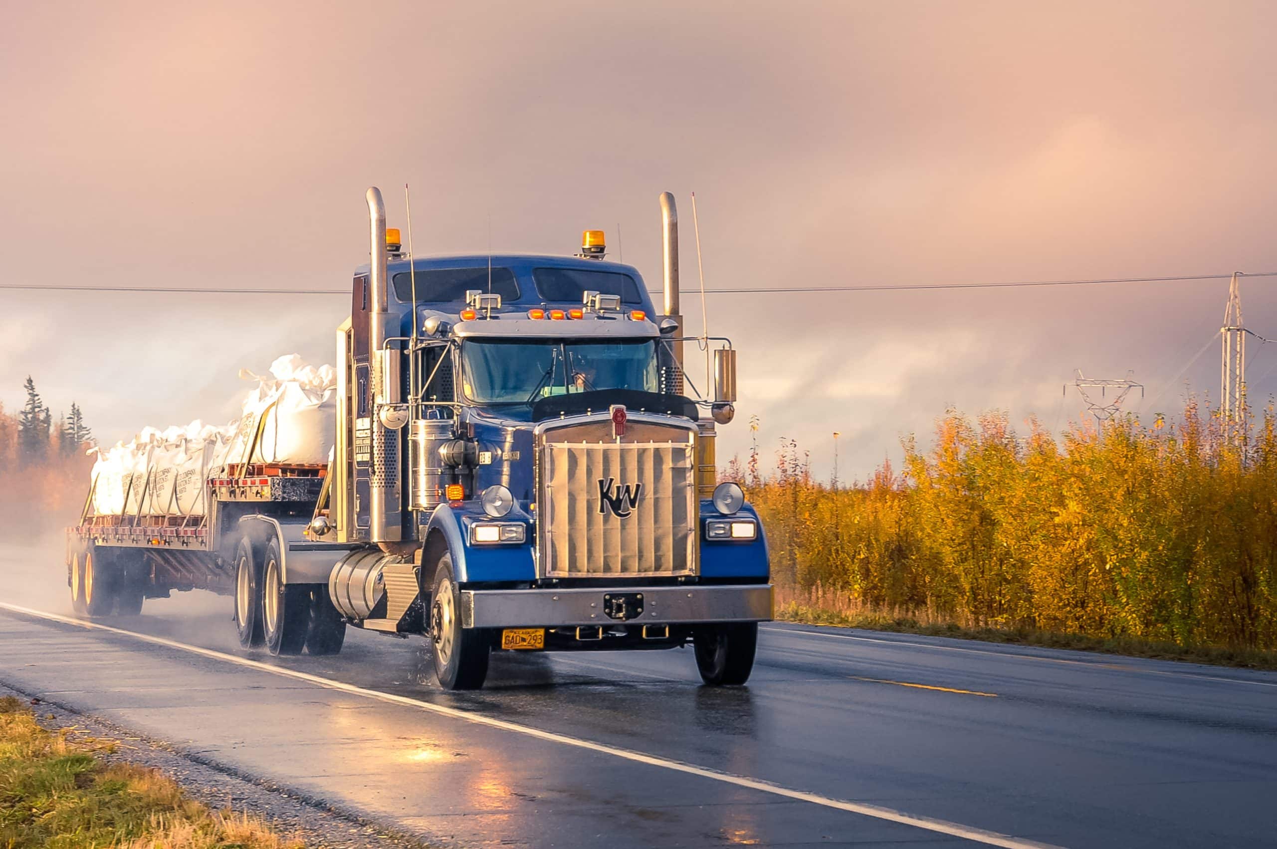
Major wireless network carriers are in the process of phasing out their 3G networks – commonly referred to as the 3G sunset. This is the period when wireless carriers will shut off their 3G services to make room for upgraded connectivity. When this occurs, all devices that are not 4G (LTE) compatible or higher will no longer receive cellular service, The period when wireless carriers make room for upgraded connectivity by shutting down existing 3G services is most commonly referred to as the “3G sunset”. All devices that are not 4G and LTE compatible (or higher) cease to receive cellular service after the transition is complete. 


While the 3G network shutdown is not expected to be completed until the end of 2022, wireless network carriers are already starting to phase out their 3G networks. With 4G and LTE services now on the horizon, the time to plan ahead is now.


What does the 3G sunset mean for my existing telematics solutions?


The 3G sunset means different things to different fleets; for fleets that haven’t yet upgraded their devices, it could mean loss of connection to vehicle and driving data. To prevent loss of data transferring (and signal), fleets with 3G vehicle tracking devices will need to upgrade to 4G devices. 


Conversely, the upgrade to 4G and LTE will provide users with a wider range of capabilities, including enhanced connectivity and speed, faster download speed and wider support for streaming and video interactions. Unfortunately, this means that 3G devices will no longer work or be supported.


What can I do to prepare?


Fleet managers will want to check all of their installed devices to determine how many still operate on a 3G network. You will definitely want to consider reaching out to your GoFleet Account Manager to determine whether your devices are 3G or 4G, as well as what plans are available to you in order to avoid disruption of service. 


Fortunately our team prides itself on expandable, scalable business solutions for fleets of all sizes. Your account manager will be more than happy to work with you to create an installation plan for your new 4G devices to ensure a seamless transition.


Fleets can start protecting their technology investment by selecting devices and telematics solutions that are scalable and adaptive. Don’t be caught in the middle of a massive service disruption by assuming the 3G sunset doesn’t apply to your fleet. The move towards 4G — and increasingly 5G — is inevitable. Knowing what lies ahead and adopting flexible technology will help your fleet stay agile.

OEM, gofleet, transportation, truck

The Appeal Of Original Equipment Manufacturing, And Why Your Fleet Might Need It

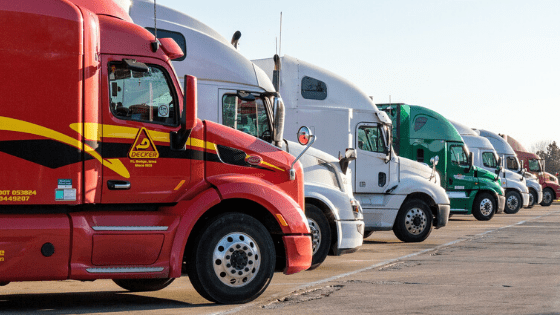
With all of the well-researched benefits of having a telematics solution for your fleet, the question is no longer whether or not you should have one, but rather which platform solutions will work best for your business needs. 


Chances are, if you can start your car’s engine remotely or use your car’s OnStar system, you’re already familiar with how original equipment manufacturers (OEMs) work. Most major automotive OEMs currently produce vehicles that already have built-in telematics hardware, which integrate seamlessly with software designed specifically for fleet management. In fact, since 2016, vehicles manufactured with telematics hardware have become the norm. 


Why OEMs add value to your fleet — and your business


By now, you have at least a passing familiarity with Geotab — an open platform that connects commercial vehicles to the internet and provides web-based analytics to help companies better manage their fleets. Geotab automates operations by integrating vehicle data for enhanced security, safety and efficiency.


The Geotab OEM Data Platform aggregates third-party telematics data from OEM vehicles and makes it available on MyGeotab. Currently, Geotab offers Ford and GM Pilot Programs, which allow clients to test various OEM vehicle solutions. 


This solution has a specific value-add to fleets that already have vehicles with embedded telematics devices. Essentially, you can use the OEM data platform to access the additional data you need without having to replace the fleet you currently have. There’s no hardware or installation cost, and no delays related to shipment or installation — your vehicles can get on the road and you can have peace of mind.


By building telematics hardware into their vehicles, automotive manufacturers can now offer unique business solutions that integrate seamlessly into the existing work processes of any fleet. Having “smart” vehicles with hardware that’s telematics-ready means you can use fleet management telematics immediately, without custom installation or laborious uplift. Hardware that’s factory-installed means fleet managers can instantly subscribe to their telematics service of choice and collect data from their fleet vehicles. 


GoFleet’s Geotab OEM offerings 


New OEM integrations mean you get software solutions that are both geared towards fleet management and a source of deeper, richer analytics, data and insights. However, it’s difficult to have a one-size-fits-all fleet solution; not all vehicles perform the same tasks, and if only a portion of your vehicles have OEMs, you’ll have a set of diverse needs that need to be augmented when needed.


GoFleet’s Geotab integration blends seamlessly with OEM data platforms, with comprehensive telematics solutions that are feature-rich and scalable. Whether you’re looking for OEMs or aftermarket telematics solutions, our extensive integration enables your fleet to acquire incoming information, including diagnostics and repair sessions (which can be done remotely), automated job site coordination, and machine guidance. 


At the end of the day, knowing your business needs in both present and future states will enable you to make the best decision for your organization. GoFleet has flexible telematics solutions that can adapt to different types of fleets and services. Our Geotab Integrated Solutions are used with all types of vehicles, including GM, Volvo, John Deere, Mack and Ford; no installation or additional hardware required. 


OEMs ensure that quality, reliable service is available to your organization, so that you can focus on what matters most — managing safe, productive and efficient fleet operations.

Let us show you how to connect your operations with one integrated platform — contact the GoFleet team for full program details.

shipping times, semi conductors, gofleet

Global Semiconductor Shortage: Impact To Shipping Times

Due to a global shortage of semiconductor production, many businesses are feeling the effects. Not only are car manufacturers hit by this, but fleet management organizations as well. Which as a result, could impact numerous fleets around the world.

A Deeper Look Into What Caused The Shortage 

In recent news, a semiconductor or computer chip shortage was noted. While there is no definite cause for this, many are accounting the shortage to be a result of various factors which include the following: 

  • Factory shutdowns that happened as stay-at-home orders were put into effect 
  • An increased need of technology required for work-from-home orders
  • A surge in cryptocurrency 
  • The 3G network shutdown prompting fleets to upgrade hardware 

All of these play together to result in there not being enough computer chips for the new development of certain products. While it’s easy to assume the impacts to the production of computers or other computer-chip dominated items, other sectors are feeling the impacts.


How Fleets Will Be Impacted 

It is important that fleets in all industries pay attention to these events as it could impact their operations. If there is certain hardware which requires semiconductors, it could mean that fulfillment will be delayed on a global scale.


What The Shortage Means For GoFleet Customers

GoFleet customers should keep in mind that Go Devices use semiconductors with the hardware. The computer chip is the core of the device to allow data to be collected and transmitted to the various solutions fleets are leveraging in MyGeotab. Without the chip, the devices would not be able to display real-time information or be interconnected with your fleet.


What You Can Do

We are urging our customers to review their yearly plan and factor is the global shipping delays for new hardware. Some delays will be upwards of 60 days and depending on the hardware requirement, it means that fleets will need to put in purchasing orders earlier. 

If your fleet is thinking of purchasing specific hardware for compliance or network updates in regard to the Canadian ELD Mandate or the 3G network shutdown, the global shortage must be taken into consideration.

If you would like to learn more about how the shortage in semiconductors may impact plans for your fleet in 2021, please contact our Success Team today. We will work with you so you can put a plan in place to ensure your organization feels the least amount of disruption.

keyless entry, geotab, car sharing, telematics, fleet, key

Everything You Need to Know About Keyless Entry and Car Sharing in Fleets

When productivity and efficiency is addressed in fleets, typically attention is never brought to key management. However, with keys being easy to misplace and hard to manage, there is a lack of efficiency that often goes unnoticed. 

With the introduction of keyless entry with Geotab Keyless, the management process will be simplified as fleets will embrace more freedom with keys going digital. Geotab’s IOX add-on for keyless functionality with integrated key fobs will convert a smartphone into the key giving drivers access to the vehicle when in close proximity.


How to Know Whether Car Sharing and Keyless Entry Will Work for Your Fleet

If your fleet falls under one of the following categories, car sharing would be a great choice:

  • If you’re a corporate or government fleet that only needs vehicles on an occasional basis or a fleet manager who needs to pool vehicles together for multiple drivers to share
  • If you’re planning to have a car sharing business
  • If you’re a dealership, test driving can become much easier with keyless entry giving you, the manager, full access over the vehicle going out for a test drive
  • If multiple drivers are able to or need to access the same car
  • If you’re a small fleet wanting to make the most use out of your fleet without expanding
  • If you’re a large fleet who often deals with vehicle confusion, mismanagement and theft
  • If your fleet isn’t always returning to one area but is situated in different locations
  • If drivers aren’t using their own vehicles and are being provided with vehicles for part time use


How Geotab Keyless Can Be Leveraged 

Taking a look at the manager’s perspective, micromanaging vehicle utilization can become efficient and straightforward. When keyless entry strategies are implemented within MyGeotab, fleet management can expect to notice the following: 

  • Visibility of all vehicles in a fleet and where the vehicle is located on one map
  • The ability to find a driver and assign them to a vehicle within minutes
  • The ability to unlock, lock and even completely shut down a car (when the car isn’t in motion)
  • Access to various other features offered by Geotab in MyGeotab

From a driver’s perspective, an app on their smartphone will inform them about the vehicle’s location and allow them to access the vehicle in close proximity. 

It should be noted that being out of cellular coverage will not be an issue. When you are out of range, the vehicle will be accessible via Bluetooth Low Energy (BLE) technology. As BLE is a simple highly automated wireless local data network that enables informational communications between assets requiring no barcode, no paperwork nor wire to operate the network, it is part of the success of keyless entry. 


What are the Benefits of Keyless Entry?

After the implementation of keyless entry, fleets can typically begin to notice 4 main benefits:

  1. The process of switching between vehicles being as simple as leaving one vehicle and getting in close proximity to the other one you are assigned to, hence, the process of returning/receiving keys will come to an end.
  2. Vehicle ownership won’t be required as the concept of car sharing will be applied.  Drivers won’t own the car since the manager is in full control of the vehicle and can restrict access immediately for any reason.
  3. Since car sharing is now simplified, managers can make more use of every vehicle in their fleet resulting in more productive routing and planning to increase profits.
  4. If vehicles are only accessible by smartphones, it will be more difficult to steal a vehicle. Moreover, with the additional addon of a vehicle immobilizer, the vehicle can shut down completely and even if someone breaks into the vehicle, it can’t be operated.


Interested in Keyless Entry and Car Sharing? Additional Points You Need to Know 

To install the Keyless entry IOX, it’s important to know that one of the key fobs must be soldered within the hardware as a permanent fit.

If a vehicle operates with a key rather than through push-to-start, one of the vehicle’s keys must remain inside the vehicle for the driver to use. However, since the key will be inside the car and not with the manager, the issue with using and exchanging keys will no longer be an issue. 

As well, since cell phones will become the new key for the vehicle, drivers must be made well aware that the mobile device requires enough battery life at all times to ensure the digital key functions properly.

With Geotab Keyless entering the market and car sharing dominating various vehicle-based industries, it is predicted that fleets will increasingly begin to leverage keyless strategies. Since the simplicity of a keyless entry process requires minimal hassle with getting into the right vehicle and even changing between vehicles, it’s something many fleets won’t be able to overlook.

As we’re dedicated to always help to improve operations and efficiencies in fleets of any size, keyless entry is something that many businesses should look into. To learn more about Geotab Keyless and how it can help increase productivity and efficiency, contact us to speak with our Car Sharing Experts!

COVID-19 Recovery: Why Your Vehicle Data Is More Essential Now

The past few months have been an unsettling time for many workplaces as the COVID-19 pandemic has drastically affected businesses. Since this global pandemic started, Geotab recorded and reported on datasets to help fleets better understand the current landscape. As we are on the road to recovery, it is important for businesses to review how the commercial transportation sector is performing in relation to their own performance. Reviewing industry trends alongside personal vehicle data can allow fleets to make actionable decisions moving forward. 

Below we use Geotab specific data that was updated on May 29, 2020, to help our readers better understand current commercial transportation activity, industry-specific activity, and fuel fill-up activity in relation to their operations. 


Commercial Transportation Activity: A Slow Increase 

With a baseline of February 2020 being used, it is clear to see in the image below that in comparison to the lowest dips in April 2020 (when many cities were in peak-response to COVID-19), there is a slow increase happening across the world. This is seen specifically in Canada, the United States, the United Kingdom and Australia. While there appears to be a rise and dip effect occurring, many view it to be a good sign that the dip does not last for long, as well that the rises are gradually increasing. 

Source: Geotab 

When speaking about the future, many believe that when businesses begin to reopen, their activity will drastically affect this graph. It is predicted that with more businesses reopening and requiring more inventory, stock or supplies, more vehicle use will occur. 


Industry Vehicle Activity: What Is Happening During The COVID-19 Recovery


While the above graph may show positive signs that vehicle traffic is increasing, it’s important to note that it is not the case for all industries. Since February 2020, there are a number of industries where vehicle activity has not recovered as much as others in North America. These industries include non-freight transportation, healthcare services and business services. Many account this lack of recovery to be due to many unique businesses not reopening, or being unable to reopen to full-productivity. An example where this is visible is in the public transportation sector which has seen a continual decrease in activity as public transportation use is low (possibility as a result of the public not commuting to work as they are working from home). 

Source: Geotab 

Some industries to highlight that are steadily increasing are construction, government, freight transportation, retail and telecommunications. This slow increase is typically due to the reopening of many businesses that could no longer hold off operations and were approved by governments to slowly reopen. For example, within the construction industry, the longer work was paused, the longer the delays for construction to be completed. When speaking about condo developments or other development projects, many companies could not financially afford to hold off construction due to financial and contractual responsibilities to home buyers. 


Fuel Fill-Up Activity: What Increases Can Mean 

In North American the vehicle telematics data gathered by Geotab confirms that fuel fill-ups of varying larger-sized vehicles are increasing. The data shows that since the end of April, there has been a noticeable increase in the usage of LDT (light duty trucks) and MDT (medium duty trucks) vehicles. This is likely in accordance with traffic increases for industries who are looking to resume operations. It is important to note however, that there are some vehicles such as MPV (multi purpose vehicle), passenger and bus that may not see such increases in fuel fill-ups until there are less restrictions on public contact and public outings. The steady increase in varying industries is important to monitor because it allows for vehicle-based businesses to see how their specific industry is performing overall. 

Source: Geotab 


What Your Vehicle Data Means 

Properly Collecting Data 

With all of this information available, it’s important for businesses to use it to their advantage. Specifically, by reviewing the vehicle telematics data of their own business in accordance with industry competitors. By using telematics solutions businesses are able to review current operations and see whether their organization is on par with industry trends.


Collecting Your Own Data 

In order for businesses to truly see results from the data gathered by Geotab, there must be processes in place to collect information related to their fleet. If no solutions are currently in place, or businesses are unsure about what should be used, the first step is to use a GPS tracking device like the GO9. For the purpose of this discussion, the GO9 can be used to record the GPS location of vehicles and depict usage within detailed reports. As well, it allows for easy add-on hardware through an IOX expansion port to allow for future tracking of HOS ELD, auxiliary, temperature monitoring as well as other third party monitoring solutions.


An additional tool to use to properly measure against the industry trends mentioned above, is to implement a fuel card integration. Using a tool like FuelBi allows fleets to better track the fuel fill-ups of company vehicles. While the device initially focuses on tracking and visualizing important fuel KPI’s and transactions, it is also used to monitor how frequently company vehicles are being filled. This directly shows the usage of company vehicles.


Comparing Company Data To Industry Data

When businesses reach the point that they have accumulated enough data to properly view how their fleet is performing, it can then be compared to the industry trends above. After reviewing the data in accordance to current industry trends, business owners and managers are encouraged to adjust their operations accordingly. What this means is that if businesses see that they are performing at a lower rate than their industry, they need to research why. Sometimes a lack of operational customers or possibly a decrease in availability of your team are the answers. As there are various reasons for why your business may not be recovering from the COVID-19 pandemic at the same rate as competitors, it’s important to work with professionals who can point out why this may be happening and offer solutions that drive results. 

Interested in working with a team who can help? Contact GoFleet today. Our team is experienced in data analyzation and consultation as our goal is to have every customer outperform their competitors. 

Precision Farming: How Technology Can Improve Efforts

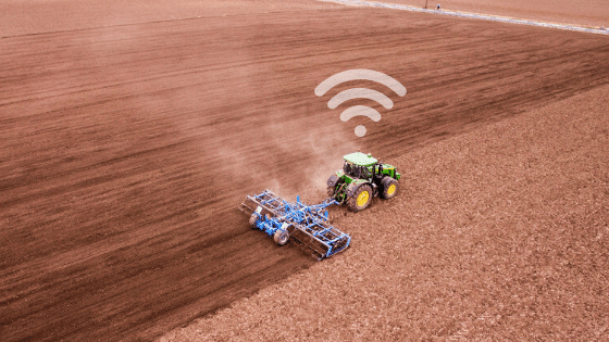
Even though many still envision farming to be very labor intensive, it’s important to highlight how this has changed. Specifically how the agriculture sector has been adopting innovative technologies that pair with heavy machinery to boost efficiencies. And as a result, allowed for time-specific operations to be met regardless of changing variables. Below we discuss how telematics and precision farming is the new normal for countless agribusinesses within the agricultural and agri-food chain.


Telematics And Precision Farming: What Is The Relationship  


As briefly mentioned, telematics continues to find new and impressive uses. When speaking to agriculture, the implementation of telematics began in the early 1990s. This was largely due to GPS guidance being used by tractors. Since then, a lot has changed in terms of the advancements. Specifically the increase of precision through the combination of methodology and technology. Or, otherwise known as precision agronomics and precision agriculture which boosts the accuracy of farming techniques when it comes to planting or growing crops. 


Precision agriculture happens by collecting information via sensors or devices which then uses cellular and satellite connections to transmit the data to varying locations. Typically this information is sent to the cloud to be stored as well as other devices where software solutions are able to utilize the data. All of which allows users to go in at a later date to view and make appropriate changes. 


Such adoption of sensors, trackers and other tech-tools in agriculture operations have allowed for a unique ecosystem to be formed. This is not only visible in personal operations where the data, tools and actions work hand-in-hand, but in the agricultural sector as a whole because findings or techniques are often made public. With this being said, there is a lot of opportunity for tech-driven agriculture to grow, with many predicting for even more growth to happen in the upcoming years. In fact, it is expected for precision farming to increase from being a market worth USD 7.0 billion to USD 12.8 billion by 2025, at a CAGR of 12.7%. 


Where The Original Need Comes From


As one can imagine, farming and agriculture work can be extremely labor intensive. Meaning, tools that can reduce the physical strain (and double as tools that make it more efficient) couldn’t be overlooked once suggested. When speaking to agriculture, it was found that telematics technology could be implemented into everyday practices to help move processes along and reduce errors that lead to wasted resources. Ultimately allowing for more work to be completed in a shorter time frame with less waste of seed, fertilizer, fuel and time as new precision was found. 


Precision Farming 


As mentioned before, precise farming or otherwise known as precision agronomics speaks to combining methodology with technology. Meaning farming techniques are adjusted to allow for more precise planting and crop growing. 


There are four tools and/or techniques to highlight which include; variable rate technology (VRT), GPS soil sampling, computer-based applications and remote sensing technology. 


Variable Rate Technology 


Variable rate technology refers to the ability of farmers placing specific controls on certain locations. Specifically changing the amount of inputs they apply. VTR focuses on using software, controllers, as well as differential global position systems (DGPS) to adjust their efforts. 


This technology is useful to ensure that resources are not wasted. When seeds are planted and incorrect paths are used while planting the seeds, it could cause too many to be distributed in one location (as a result of overlap passes), causing for growth to be limited. With VTR, controls can be used after environmental data is analyzed to ensure that seeds are planted appropriately. 


GPS Soil Sampling


GPS soil sampling refers to the testing of the soil in a specific location. Focusing on the available nutrients, pH levels, and other information that can affect how well a crop may grow. Understanding this is critical because without this information, individuals planting crops may not understand how they could have a more successful season. Sometimes it can be as simple as gathering data from the soil, analyzing the information, and applying certain precautions. Such precautions could be as simple as distributing fertilizer because the soil is naturally lacking some nutrients. 


Computer-Based Applications


Computer-based applications are highlighted for their abilities to create various plans and maps including farm plans, field maps, crop scouting and yield maps. These applications allow for precise actions to happen in regards to application of inputs (pesticide, herbicides, fertilizers, etc) on a visual and geo-specific level. Resulting in knowledge of the ground level, type of soil, among other environmental aspects to be known so more direct actions can take place. 


These applications can allow farmers to better understand the environment where they are going to be planting. As the leveling of the ground, type of soil and other information that farm plans, field maps, crop scouting and yield maps hold may require farmers to take extra precautions when planting. Telematics implementation via computer-based applications pull all of this and display it for farmers to better understand pre-planting needs. 


Remote Sensing Technology 


Remote sensing technology is exactly as one may expect – sensor technology that can remotely monitor and manage certain efforts. For agriculture, this can be seen at times when there are certain stressors affecting the quality of the crop such as hot temperatures eliminating moisture from soil. Sensors can be used to monitor all of this and alert farmers of certain conditions that may be harmful. When discussing the example of hot temperatures eliminating moisture from soil, sensors can detect when the soil has reached a specific level of dryness, prompting teams to add additional water. Forgoing alerts from sensors means that teams will have to physically monitor and estimate not only when to make changes but how much change should be made. 


Additional Benefits Come From Telematics In Farming


Depending on the work being performed, some farming operations may find certain telematics solutions more useful than others. Since high demands, changing environmental conditions, and fluctuating weather patterns can all affect the agri-industry, there is an ever-evolving need to adapt. For farming and agriculture, the solution is technology and tools to allow for precision farming. 


While the purpose of the technology can vary, the benefits that arise are typically the same. Usually, the telematic solution will increase efficiency, boost resource utilization, improve monitoring of efforts, aid security and increase maintenance management, among others. These benefits are further discussed below. 


Increased Efficiency And Resource Utilization 


As previously mentioned, telematics solutions can be extremely beneficial within the farming sector as it allows for operational efficiency. For example, one tool that has not been discussed yet, GPS tracking technology, can be leveraged to increase efficiency and resource utilization. This is because GPS tracking can allow for teams to monitor where equipment is or has been throughout the day. In fact GPS tracking or other high precision positioning technology has been adopted in nearly 80-90% of the tractors in the Western world. Tracking this data and mapping it ensures that the planting of seeds is precise and there is no overlap passing as previously mentioned. Ensuring that the right quantity of seeds are planted to lower wasted resources and reduce overlap of paths to reduce wasted fuel. 


Virtual Monitoring And Optimized Efforts 


In addition to boosting efficiency and resource utilization, telematics helps to monitor conditions to optimize efforts. As briefly mentioned, knowing specific information about crops and environmental factors can drastically affect the outcome of the crop. For example, a crop that has soil that is too moist or too dry could be difficult to notice unless someone is walking through fields or crops and checking on the conditions. However, with telematics, devices can be implemented to gauge what the conditions are like in specific geofence locations – so if one portion seems to be too dry, teams can optimize their efforts and rewater as necessary. 


Security 


As telematics focus on tracking the GPS location of assets, many are finding that telematics can act as a security tool. When GPS location tracking information is displayed on a visual map, teams can know where equipment and heavy machinery is located – and in some cases, see the ‘last known location’ if the asset is no longer on the map. Using telematics tools to track location helps during the recovery process if assets go missing as the last known location and even in some cases the current location can be tracked. 


In addition, geofences can be used and set up to alert teams when an asset is removed from a pre-set zone. All of these features result in theft of heavy machinery (which can be costly to replace) to be reduced, as well, for missing equipment to be found sooner so replacement costs are avoided and perpetrators are prosecuted. 


Maintenance And Troubleshooting From A Distance 


With telematics technology installed, heavy machinery and equipment can have their health status monitored. Specifically as telematics can not only record how the asset is being used, but the data can be inputted into software solutions and applied to algorithms to determine how the asset is performing. In many cases focusing on the efficiency of the vehicles (fuel usage and idling) or preventative maintenance scheduling. Preventative maintenance is a major benefit to highlight as using telematics and IoT connectivity can help to reduce the likelihood of unexpected breakdowns that halt work as well as the need to bring heavy and large equipment to be serviced unexpectedly. When this is not prepared for, owners of the machines risk high costs related to transporting the equipment, conducting repairs and even lost time. Using telematics for preventative maintenance has been known to reduce repair costs by up to 25% if performed regularly. 


How GoFleet Is Helping


Above are only a few of the general benefits that companies within the agricultural and farming sector have noticed after implementing telematics. While these benefits and the extent of improvements differ from business to business, speaking to a solutions provider about your specific needs and industry can help. With our experience, we’re confident that our team can take your unique needs and find a solution that allows you to see measurable results. 


John Deere Program 


One available solution to highlight, is part of the OEM (original equipment manufacturer) program via the Geotab integrated solution for John Deere. The telematics solution works to provide more information through a number of agriculture-related equipment to boost reporting, monitoring and machine operations. 

How Commercial Transportation Is Impacted By COVID-19

In recent news, not only has the medical community been affected by the outbreak of coronavirus, but the global supply chain as well. On March 11, the World Health Organization declared the recent outbreak of COVID-19 as a pandemic due to its sudden and concerning spread. In order to combat the spread of the virus, the public has been told to practice social distancing and many businesses have even been told to close their doors. However, it’s important to note that these are not the only changes that are happening as a result of the outbreak. In fact, the commercial transportation sector is finding that the public’s new way of living (as a result of being impacted by COVID-19) is also changing their operations. 


Below we discuss an overview of how the transportation industry is affected by leveraging fleet data provided by Geotab via intelligent solutions. Please note that the data was gathered on April 10, 2020, via their blog


How The World Is Impacted By COVID-19


With coronavirus infection numbers growing, there have been numerous efforts put into place to limit the spreading of the virus. One effort, the closing of numerous borders, may have affected travel, but not commercial transportation. Borders still remain open for those transporting goods because of the increased need of supplies and equipment in wake of the city lockdowns, community social distancing and more. 


Initial Changes In Commercial Transportation 


When discussing how essential the transportation sector is, as they are still able to travel across borders for deliveries, it’s important to highlight how there has even been movements towards making transporting essential cargo easier. Specifically the Emergency Declaration issued by the FMCSA and the Essential Freight Transport Exemption which was put into effect by Transport Canada. Both of which focus on adjusting the hours of service (HOS) regulation that drivers within the transportation sector must abide to. These changes allow drivers to drive over the maximum HOS in their country (meaning strict HOS regulations have been changed as a result of COVID-19). However, even though transportation seems more important than ever as they provide relief to communities needing essential supplies, it’s important to look at how the volume of commercial transportation vehicles may be changing. Specifically how the volume (which includes the number of trips and the amount of fuel used) has changed since the month of February.


Affected Volume In Activity 


As one can imagine, there are countless changes happening to various industries. But when speaking to transportation, a decrease in commercial vehicle activity has been noted. Analyzing data that was collected from Geotab (from the dates March 15 to April 10), a noticeable decrease can be noticed in the percent of normal activity. With a baseline starting before March 15, continuing to April 10 – the time when many countries and industries started to be greatly impacted by COVID-19. Below is a graph which depicts the longitudinal view of commercial traffic volume that is being discussed. Specifically measuring the number of trips relative to normal activity, as well as the type of vehicle used. 

Source: Geotab; The impact of COVID-19 on commercial transportation and trade activit


As illustrated on the graph, various vehicles including heavy-duty trucks (HDT), medium-duty trucks (MDT), light-duty trucks (LDT), multi-purpose vehicles (MPV), as well as cars declined over time in regards to the amount of activity tracked. 


This decline is visible in a heatmap provided by Geotab when looking at data in regards to operating percentages and locations (micro regions in the U.S. and Canada). The chart compares what the normal operations percentage was in February 2020, to currently, in April 2020. 

Source: Geotab; The impact of COVID-19 on commercial transportation and trade activity

Source: Geotab; The impact of COVID-19 on commercial transportation and trade activit


In terms of Canadian changes, when looking at data from most recent weeks, compared to data from February 1 to March 15, Canada appears to be operating at 74% of normal commercial transportation activity. It’s important to note that the Maritimes is operating at the lowest when compared to normal – 67%. In comparison, the U.S. has also felt a large impact. The U.S. is operating at an average of 75% of normal commercial transportation activity. Reporting that the State of New York and New Jersey are the most impacted. They are only operating at 55% of normal activity. 


In brief, some other changes to highlight are; 

  • Ontario operating at 76% in comparison to 97%
  • Quebec operating at 68% in comparison to 99%
  • The West (US) operating at 68% in comparison to 100%
  • The Mid-Atlantic (US) operating at 74% in comparison to 100% 
  • The Midwest (US) operating at 76% in comparison to 98%  


Affected Fuel Usage 


With countless vehicles contributing to the commercial transportation sector, it’s also important to look at how these vehicles and usage are changing in terms of fuel during this time. Specifically looking at how fuel usage may be impacted by COVID-19 through decreasing commercial transport activity. 

Source: Geotab; The impact of COVID-19 on commercial transportation and trade activity 


The graph depicts that at the start of March 2020, there was a steady quantity of fuel being used among commercial vehicles. The data focused on vehicles that included buses, HDT, LDT, MDT, MPV, and passenger. A general decrease started on March 15, and continued until March 26. Since the end of March, the use of fuel in most cases did not recover to quantities previous to COVID-19, but is occasionally going through dips.


It is important to note that decrease was not as apparent within the trucking economy. Some may assume this is because while some operations may have changed, many commercial vehicles are still essential to transport supplies and equipment during this time. When reviewing the data of how the fuel usage of buses and passenger vehicles has dropped greatly, many assume it is because those vehicles are typically not operating at a high frequency due to health and safety recommendations. This includes how the public has been told to work from home (so there are less commuters) as well how the public is told to socially distance themselves from each other and stop public gatherings or events (so there is less travelling for leisure purposes).  


During This Change, Safety Is Critical 


With commercial transportation still remaining steady (with only minor dips) in terms of fuel use and volume, it’s safe to say that the industry is still steady. What this means is that even at a time where so much is in flux, the transportation sector is critical for many communities as they can provide essential supplies among other necessities.  


However, with so much uncertainty surrounding coronavirus and how businesses are impacted by COVID-19 in terms of safety and the length of the pandemic, it’s important for those who are on the frontlines to do what they can to stay safe. One way when speaking to the transportation sector, is for drivers and other delivery personnel to monitor for potential symptoms. Proactively monitoring for coughs, fevers and other signs of viruses can help reduce the possible and unknowing spread of the virus. Especially when speaking about individuals who are travelling constantly and moving cargo. Tools like ZenduCheck, a digital symptom monitoring app, allows drivers and other essential personnel to monitor their health. To learn more about how symptom monitoring can be useful in promoting safety in fleets, click on the button below.