government fleets, telematics, gofleet, fleet management, productivity

How Government Fleets Can Benefit from Telematics Solutions

Local government and public works agencies rely heavily on datasets to improve their operations, satisfy their constituents and plan their community more effectively. What typically remains top of mind for most government agencies is the safety and satisfaction of their citizens. To this end, telematics can help achieve these goals by providing visibility into the inner workings of their services and fleets, creating a partnership with the public rather than an autocracy.


From vehicle tracking to functionality, telematics can have a positive impact on government operations. For example, a winter maintenance fleet manager can have specific data at his fingertips, including when plowing occurred and when, and even how much salt is left in a vehicle. The right telematics solution will help save costs, improve safety and overall operational efficiency, and help fleet managers monitor the status of services while tracking their assets on a single platform. Here’s how telematics can improve your government operations.


Single sign-on


Not all government vehicles are plows and spreaders, which is why it’s important to be able to manage all assets within your organization through one system. Managing your entire fleet through one platform reduces training, reinforces information and highlights inefficiencies.


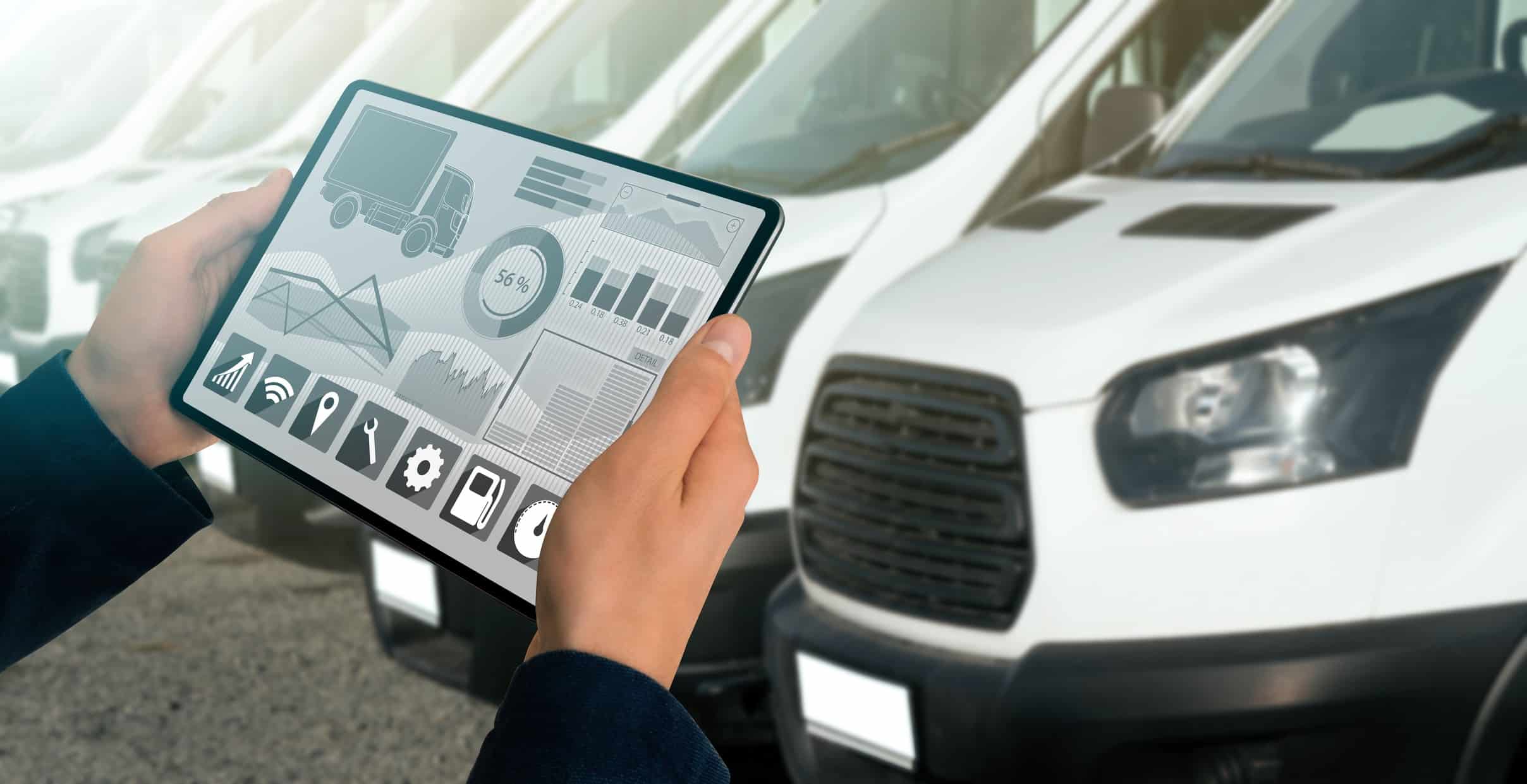
A centralized, cloud-based “single source of truth” allows you to track assets in real-time while managing their maintenance and controlling costs. Telematics can automate your processes and eliminate hours of manual data processing, giving you more time to focus on decision-making, training and efficient operations.


Automate and manage your assets


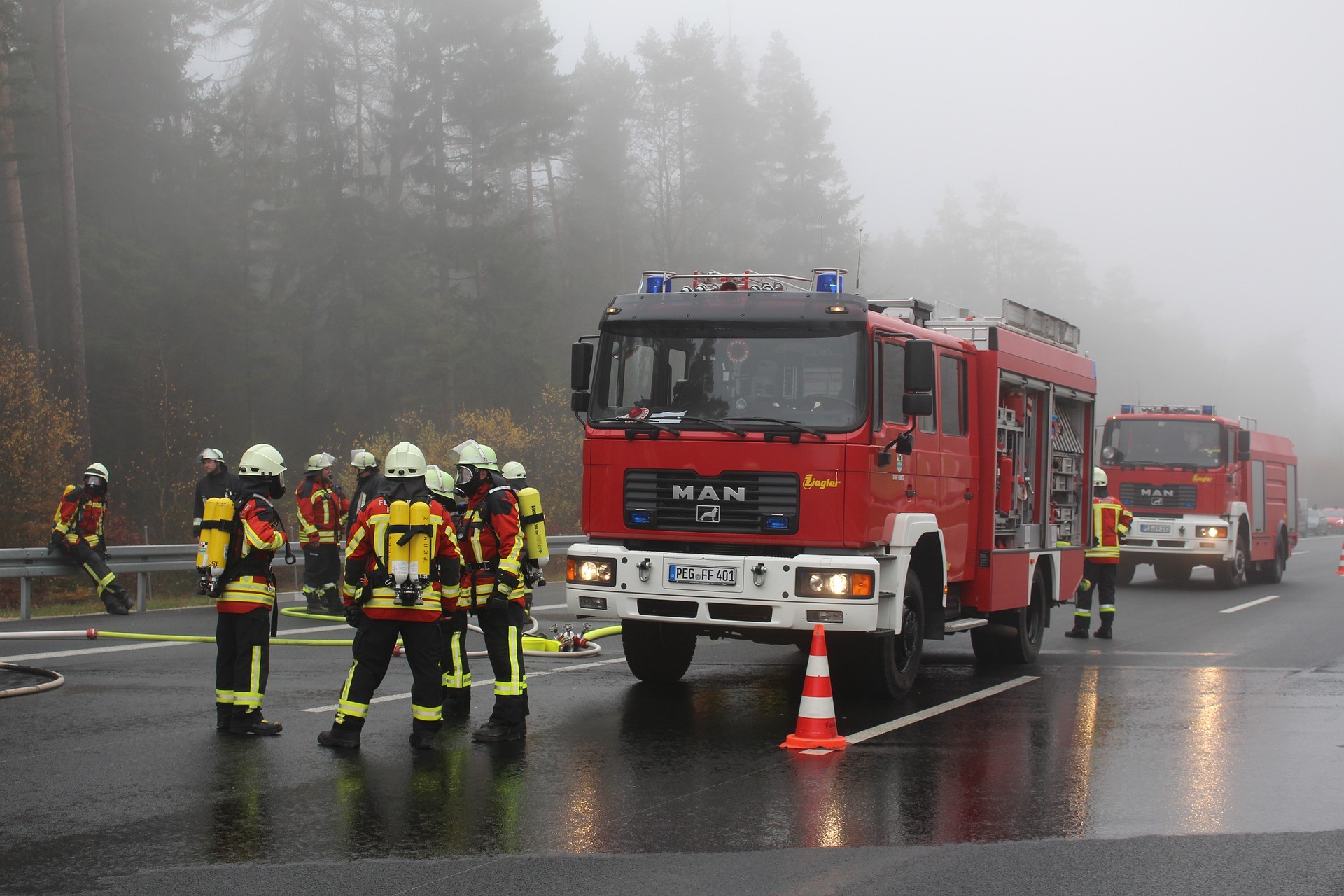
Government organizations provide essential services and critical infrastructure that support the daily activities of residents and businesses. In addition they are responsible for maintaining service level agreements, infrastructure planning, policy and ensuring the best use and deployment of expenditures and assets.


Because government fleet managers and leaders typically oversee a diversity of vehicles and assets (usually in the form of unique GPS tracking), an integrated telematics solution would offer full visibility into the operational data of all government vehicle types on a single platform, providing the tools to maintain compliance and road safety while reducing costs.


When you increase your fleet’s capabilities, you can measure material usage and ensure equal delivery of services within the community. Ultimately, these datasets lead to lower costs and a reduced environmental impact.


Asset health


Whether seasonal or otherwise, repairing infrastructure and conducting road work is tough on vehicles and assets. Telematics allow you to monitor asset performance to ensure you get the most out of them. When you track asset utilization, such as average daily mileage and service history, you can increase their lifespan and improve your bottom line.


The right telematics solution will compile both historical and real-time data usage so you can proactively decide how best to maintain and use your assets. From forecasting future repairs to predicting vehicle replacement, the fleet reports offered from telematics data give valuable insights into performance and maintenance, giving you a holistic overview of your fleet’s health.


Increase productivity


The unfortunate truth about many government operations is the tendency towards using old management methods, such as spreadsheets, that offer little to no insight into asset usage. When you don’t know the health of your fleet, you can’t prepare for potential work, which can lead to unplanned downtime and reduced efficiency. It is essential to have an automated telematics management system that can track and manage your fleet in real-time so you can maintain productivity.


Manage public perception


In the end, government fleets answer to the governed. Give your community access to visibility and help fight false claims with historical reporting and analytics. Provide proof of vehicle location and services rendered; show your constituents how to track vehicles themselves with a public map they can easily access and maneuver. Transparency can foster a positive relationship with the public and improve overall satisfaction. 


Use telematics to turn your fleet data into insights and action. Support your key government business drivers, including asset management, compliance, accountability, and efficiency. Contact your GoFleet specialist for your special offer, and schedule a demonstration today.

natural disaster, fire fighters, first responders, fire truck, telematics, dispatching, emergency

When Natural Disasters Strike, The Need for Telematics Increases

Frontline workers and first responders are under enormous pressure, and sometimes, depending on the emergency, the pressure to help those in need will increase. During these situations, potential lack of efficiency, response structure and training will appear as fleets that are inexperienced or unprepared could make the wrong decisions. To ensure this never happens and that response teams are always ready, fleets responding to emergency scenarios must appropriately leverage telematics to boost training, overall safety and organizational efficiency.


The Stress of Responding to Natural Disasters 

Natural disasters can be complicated. As they often come with little warning and have unpredictable outcomes, response teams must be prepared for almost anything on short notice. Recently in 2019, the US faced 108 fatalities and countless casualties as a result of natural disasters which included wildfires, housefires, floods or storm surges, tsunamis or hurricanes, avalanches or landslide, earthquakes, thunderstorms or heavy rain, hail, blizzards, ice storms as well as heavy snow. With so many possible emergencies happening, teams but prepare for the worst by using the best solutions.


What Solutions Forward-Thinking Teams Are Using

It is predicted for natural disasters to continue and even increase as a result of human error or climate change, therefore, responders must continue to update how they respond to these types of emergencies by using telematics. 

With new technology such as GPS tracking and asset trackers, teams are leveraging location focused telematic solutions to prevent mistakes and monitor their response. Not only is this visible with knowing where teams are currently and where they may be dispatched, but also tracking what equipment is with which team member. For example, hydraulic rescue tools like spreaders, rams and shears (or otherwise known as the jaws of life) may be too large for every team to have in their vehicle. Meaning improved GPS location tracking can help ensure the right tools are sent promptly to the right emergency depending on the call.  

GPS tracking solutions can even help to ensure that individuals, specifically drivers are taking enough time off between calls or shifts. Often there is a concern of working overtime which may result in tired driving and accidents. Recording hours-of-service (HOS) or length of time on call through GPS data can ensure proper documentation is kept. 

Cameras that are facing both inside and outside of the vehicle are extremely beneficial for currency fleets. The footage collected is often used to reveal what happened while on-scene in terms of proper patient care and while travelling to a scene since first responders are required to drive fast to arrive quickly. Connected cameras can also help show proof or collect data to record time and routes of EMS events. 


What a 360 Solution for First Responders Looks Like 

With the aid of a telematics system, the problems that frontline workers face can be reduced or even eliminated. Here is a checklist every first responding fleet should go through when receiving their processes:


Is there proper communication between dispatchers and drivers?

Fleets can be equipped with software to provide drivers and dispatchers with firm communication. With good communication, dispatchers can easily guide their drivers through their tasks without risking mistakes. It will also help new drivers in being confident with the decisions they make and will prevent any overthinking during a critical situation.


Are dispatchers aware of all the asset locations and monitoring them?

GPS tracking solutions nowadays have the ability to allow dispatchers to get a real time update of the asset’s location. It can help in monitoring each and every step the driver takes, where they stop, where they speed and much more. 


Is the fleet doing tasks that could be avoided with advanced technology available?

Improving the workflow of simple daily tasks with the help of telematics solutions can help efficiency and organizational structure in the fleet. A perfect example would include keyless entry that makes a fleet truly keyless by transforming mobile devices into keys.


Are all the assets in the fleet being well maintained?

Vehicles in first responder fleets often go through a lot as they are required to arrive to a scene no matter if a sideway, curb or rugged road is in their way. When this happens and proper maintenance is overlooked, vehicles are at risk for more breakdowns and shorter vehicles lifespans. Getting oil checks done at the right time, checking for battery faults, and other maintenance checks should be done at the right time without delay to prevent a reduction in a vehicle’s lifespan.


What the Future Holds for Telematics in First Response Fleets

With technology rapidly evolving, it’s only a matter of time before the following solutions will be possible. Having a good idea of what to expect in the future can help first responders stay a step ahead.

Communication between first responder fleets will definitely see improvement. It could be evolved to help other fleets increase their response rates. During a potential accident on the highway, when more than one first responding vehicle is required to approach the scene of the emergency, the team receiving the call for emergency can immediately inform the rest of the team. This can come in a variety of solutions, whether it’s build-in messaging or live in-vehicle verbal driver feedback like in the GOTALK – it can’t be overlooked.

Along with strong communication, having an automatic dispatching system like ZenduWork can increase efficiency.  ZenduWork allows for easy dispatching and organization of routes, tasks, drivers and more. For example, in the case of a fire alarm being triggered, self-driving EMS vehicles and fire trucks can be dispatched. Upon arrival, the public can use the equipment in the vehicles to resolve the issue on their own.

With growing telematic solutions, first responders must take full advantage of these resources to improve public and fleet safety, as well their efficiency. Not only can it ensure their safety and proper use of resources, but it will help the public who are affected by the emergency. To learn more about how GoFleet can help implement the right solutions your fleet, depending on your current and future needs, contact us today.

State of Utah Police Fleet: A Case Study

The Need To Improve Vehicle Utilization 

For fleets to function seamlessly and efficiently, telematics solutions should be used. And that’s exactly what the State of Utah did when they found that they were struggling to follow specific state and federal guidelines that depict how equipment and vehicles should be used.


The Needs of the State of Utah Police Fleet

  • Overall fleet reporting 
  • Measuring vehicle utilization 
  • Tracking on-duty and off-duty vehicle use
  • Monitoring driving behaviour 
  • Ensuring drivers are running code and following policy 
  • Maintaining accurate historical data 


The Solution: Geotab IOX Integrations 

The State of Utah utilized Geotab’s IOX integrations to address all of these concerns. Specifically they utilized Driver ID with NFC technology (IOX-NFCREADER), light monitoring and siren usage (IOX-AUXM), and seat belt tracking. 


If you’re interested to learn more about the State of Utah’s primary challenges, the solutions they used, or the results they saw, check out Geotabs case study here: The State of Utah 

Taking Your Fleet Telematics to the Next Level

With basic telematics implemented into your fleet, you are now able to track the location, movement and speed of all of your vehicles, which helps your organization increase efficiencies, and effectively, reduce wasted time and improve costs.

So, what comes next?

Advanced Fleet Tracking
Once you have the basics in place, you can start to dive deeper into telematics technology in order to really fine tune and optimize your fleet operation.

Check out these major benefits your company can gain by implementing advanced fleet telematics solutions.

Increased Safety
By monitoring driver behaviour – things such as how fast your driver is driving and how aggressive their driving may be – you can use technology that allows you to talk to the driver and coach them through safer driving practices, thereby increasing safety for them and for your vehicle.

It has been shown that drivers who are aware that their driving habits are being monitored, are more apt to perform safer behaviour which not only increases their safety, but also reduces accidents and damage to vehicles and freight.

Increased Efficiencies
By using real time communication as an add-on to your basic telematics, and adding in some routing apps, you can manage driver routes more efficiently – if there is an accident, you would be able to re-route the driver and eliminate wasted time having them stuck in traffic with high priority loads on the vehicle.

By using some of these type of add-ons to your basic telematics, adding a few minutes more to your driver’s HOS (Hours of Service) can really increase your fleet efficiency and delivery rate.

Reduce Operating Costs
In being able to track even the smallest things, such as idling time and minimizing it, a fleet can increase savings by reducing fuel costs. Other things that can be looked at are tracking at a more granular level, such as live movements on a map, maps routing, stopping vehicles, accidents and who’s responsible, which allows for increased productivity thereby reducing costs.

Optimize Vehicle Performance
With advanced telematics, sensors can send out alerts about engine issues and other diagnostic problems. Further to that, the data can be used in a predictive manner to determine when service should happen on a vehicle and allow for advanced planning in order to ensure as much uptime for the fleet as possible and manage the expenses related to repairs.

Reduce your Carbon Footprint
It’s a hot topic these days more and more companies realize that not only is this good for business, it’s good for the planet as well. By reducing your fleet’s idling time and decreasing speeding (thereby reducing the amount of exhaust and CO2), not only are you increasing the safety of your fleet and drivers, increasing your efficiencies and reducing your costs, you are also helping to do your part in reducing emissions in the air for our future generation.

Streamline Compliance
With the Canadian ELD mandated for June 21st, 2020, it is imperative that fleets ensure they are compliant and implementing advanced telematics not only ensures this but provides many other benefits previously mentioned. In addition to the benefits, the cost of not being compliant is expensive and can be avoided with the correct telematics solutions in place.

Do you need to upgrade your telematics plan for advanced fleet tracking?
Some features are already built into your tracking device that collects the data and some solutions require you to step up to the next level of offered services and products.

In order to get the most out of your fleet telematics so that you can save your company time, money and increase efficiencies and safety, give GoFleet a call. We are here to help create a customized and fully integrated telematics solution that is specific to your needs and lets you get the most value for your money.

Advanced fleet tracking is much more than GPS services and with the telematics of the future, there are and will be so much more you can do in order to continually create the best fleet management company you can envision.

GoFleet – Connected Technology. Smarter Solutions.
Discover more about GoFleet and its Telematics Services

Active Tracking: Keeping First Responders Safe on the Road

An ambulance drives through traffic, siren sounding and lights flashing. The dispatcher is on the line, collecting vital information, while monitoring the status of the ambulance at the same time. What if that dispatcher could follow the live movement of the ambulance as it drives along the road, knowing it was safely and quickly arriving at the scene?


This is now possible with Active Tracking.
 

What is Active Tracking and how does it benefit emergency vehicles?
Play the video to see it in action.
 

Paramedic Services, Fire Departments, and Police are all under pressure from the public to reduce response times, while protecting the safety of pedestrians and drivers on the road. Technology plays an important role in this effort.

Ideally suited for first responders, delivery and taxi fleets, and any industry in which knowing the precise vehicle position is critical, EMS GPS tracking system allows customers to view their vehicles in near real-time. For example, an ambulance dispatcher can watch the vehicle’s progress and reassure a caller that the ambulance has just turned off the highway onto their street. Another fleet dispatcher could closely monitor vehicle activity and see, at a glance, if a driver is driving too fast.

Using Active Tracking is very much like watching your fleet vehicles from a traffic helicopter.
Watch live as the vehicle slows down for traffic, accelerates, stops at the side of the road, or speeds down a winding road.

How It Works

Active Tracking is made possible with increased data logging frequency and animation in MyGeotab. The animation feature displays estimates of the real-time location of the vehicle onto the live map. Users are able to watch a simulated icon of the vehicle as it is moving. This new feature provides fleet managers and dispatchers with a very accurate representation of where a vehicle enabled with this technology is located at any given time.

When Active Tracking is enabled, smart technology is used to request data from the Geotab GO Device at varying frequency intervals. Then, the data is relayed to servers for processing and the position of the vehicle is reflected on to the live map. When the triangle icon is shown, this means the vehicle is in motion. As the vehicle slows down or speeds up, that change is also reflected in the movement of the icon on the map.

Previously, data was spooled into a buffer and then uploaded when the buffer was full. With this concept, some data could have been uploaded quite fast if the buffer was filled quickly. On the other hand, if there was less overall data coming in, it took the buffer longer to get filled and therefore the data would be received much slower.

To explain the data spooling and buffer concept, we can compare it to a filling a gooseneck jug with water using a cup versus using a funnel. If you were to use the cup to start filling the jug, you would have to wait until each cup was filled, then take the cup and carefully pour the water into the jug. This process would be extremely slow. Alternatively, if you inserted a funnel into the gooseneck of the jug, and poured the water directly into it, the jug would be filled pretty quickly. There would be much less of a delay using the funnel. Active Tracking is comparable to the “funnel method.”

Using patented algorithms, MyGeotab presents that granular location information on an animated map, demonstrating the steady vehicle movement — instead of the jagged jumps that are seen with other telematics solutions. As a result, Geotab’s Active Fleet Tracking solution provides deep, actionable insights that are particularly useful in applications where the exact location of a vehicle for dispatch purposes is essential.

How to Enable Active Tracking for Fleet Vehicles

Through the ProPlus Plan, you are able to activate features such as Active Tracking, third-party integrations and other special features. Active Tracking is automatically enabled for users on the ProPlus Plan. Our customers with the Pro Plan can turn on Active Tracking on the MyGeotab Vehicle Edit page (note: enabling this feature moves the device from Pro to ProPlus). Active Tracking is also required for time-sensitive server-based notifications and rules such as posted road speed warnings for the driver using GO TALK live in-vehicle verbal coaching solution.

For more information on Active Tracking or to upgrade your current plan to include Active Tracking, contact our support team.

Source:
Original Article By: Owen D’Acres, Customer Support Specialist at Geotab
https://www.geotab.com/blog/active-tracking-first-responders/

GPS Monitoring Devices To Be Worn By Violent Offenders

Mother Pushes For Law To Require Violent Offenders to Wear GPS Monitoring Devices

Five years ago, a restraining order did not prevent Randall Todd Moore from sexually assaulting, kidnapping and shooting his wife who was separated from him, Terese Ann Lynch Moore. Now Terese’s mother, Sheila Lynch, is pushing for new law in Iowa. This law would require offenders ordered by a court to stay away from their victim to wear a GPS monitoring device. The electronic GPS monitoring device would alert the victim and local law enforcement if the offender got close.

Approximately 19 states currently have similar laws for violent offenders. Domestic violence is a real problem that needs a solution that works. In Iowa, Lynch argues, there is no solution. She believes if a law like this existed in Iowa and Randall Todd Moore was required to wear a GPS monitoring device, her daughter might still be alive.

Sheila Lynch states that it is hard for most people to understand how an offender can get to their victims. She said that her daughter stayed with her husband through years of abuse. Terese Ann was deployed to Iraq three times as a staff sergeant for the National Guard. When she met her husband, her demeanor and personality started to change. Previously a spunky woman, Terese became uncertain about herself and quiet.

Terese Ann Lynch was only 30 when her husband killed her. She would often urge people, including her mother, not to visit. Her mother noted that she felt like her daughter was sacrificing herself so her husband did not hurt anyone else.

After Terese Ann finally got a restraining order for her husband, he went to her apartment and kidnapped her. She had no idea that he was approaching her home. He sexually assaulted her and then fatally shot her in the face with a shotgun. When Moore was sentenced, he showed no remorse for what he did. He received three back-to-back life sentences. He also received 25 years for attempting to murder a Des Moines, Iowa police officer. If Moore had been wearing a GPS monitoring device, local officials and her daughter would have known he was approaching Terese’s apartment. Sheila Lynch wants a law on the books in Iowa requiring GPS monitoring device to be worn by offenders to help save other victims.

Vehicle GPS Tracking System: Government Businesses

Government Businesses Benefit From Implementing a Vehicle GPS Tracking System

Government fleet managers have to deal with government mandates on fleet utilization and size, budget cuts and aggressive goals to reduce emissions. A vehicle GPS tracking system helps government businesses meet these challenges by optimizing your fleet size, decreasing operational costs, reducing emissions, deterring vehicle theft and helping you achieve your fleet management goals.

Vehicle GPS tracking systems will provide your government business with the data you need to fully understand your fleet’s performance and the tools you need to improve it.

Reduce Labor Costs

Improved routing and dispatching minimizes the time your drivers are on the road, improves response times and helps you to prevent expensive overtime. Most government businesses see a reduction in labor costs only months after implementing GoFleet’s vehicle GPS tracking system.

Decreased Fuel Consumption

Monitoring your drivers’ speed, aggressive driving habits and idle time can be used to decrease your fuel consumption and costs. This is often the largest expense for a government fleet.

Optimize Fleet Performance And Size

When you are able to completely analyze your fleet’s performance including miles driven, days utilized, peak usage and average usage, you will be able to optimize your fleet’s performance. There are many customizable features that let you track each vehicle by location, site or department. This information will allow you to make the most informed business decisions regarding vehicle utilization and fleet size.

Deter Vehicle Theft And Any Unauthorized Use

When you use GoFleet’s vehicle GPS tracking system, you will not only deter theft, you will eliminate unauthorized usage of government vehicles. If your drivers drive off-route or use the vehicle during personal time, your fleet manager will be immediately notified. Drivers will no longer be wasting time and fuel driving off-route to get a bite to eat or a cup of coffee. This will improve your customer response times and reduce labor and fuel costs.

For more information about how GoFleet’s vehicle GPS tracking system can help your government business, Contact Us.

GPS Ambulance Tracking Available To Queensland Residents

Queensland Residents Now Have GPS Ambulance Tracking

Residents of Queensland, Australia will now be able to track the location of the state’s 1,000 ambulance fleet using a new online GPS tracking service. The location of each Queensland Ambulance Service ambulance is mapped out in real-time so the public can see the location of each ambulance conveniently on one screen.

This service is a first for Australia. It utilizes iROAM, Queensland’s Integrated Real-Time Operational Ambulance Management software, first launched in 2012 for the Queensland Ambulance Service.

iRoam was developed internally by the Queensland Ambulance Service. It uses GPS tracking to keep track of each ambulance. Operational supervisors may view many details including current case information, the amount of ambulances en route to the hospitals and the cases that are still waiting in the queue.

Although all of the case details will not be available for the public to view due to patient confidentiality, the public will be able to check out the map of ambulances. They will be able to track the vehicles’ locations and number of ambulances on the road. The public will also be able to see the number of the ambulances that are busy or dropping off patients at the hospital thanks to a link to the Queensland Ambulance Service dispatching system.

The reason for the new public GPS tracking online software for ambulances is to keep the public more informed. There is a huge public misconception that when ambulances are busy dropping patients off at the hospital, there are no ambulances available to respond to other emergencies around the state. The public will be able to feel more confident about Queensland emergency services. The Queensland Ambulance Service is using social media as a tool to dispel the myths. Their social media stream has doubled in the last 6 months.

Law Enforcement Needs GPS Tracking For Fleet Vehicles

Law Enforcement Needs GPS Tracking For Fleet Vehicles

When you are running a law enforcement agency, it is essential that you use GPS tracking for fleet vehicles to know where you are police units and service vehicles are at all times. Public safety and lives are on the line. All law enforcement agencies should have GPS tracking for fleet vehicles. Dispatchers will be able to send the closest unit to a call. That means that people will not be waiting for a unit to arrive from across town to attend to their emergency.

When you use GPS tracking for fleet vehicles at your law enforcement agency, you will be holding yourself accountable. Your local governments, citizens and municipalities demand that your police officers’ conduct themselves in a proper manner meeting the tax payer’s needs. With GPS tracking for fleet vehicles, you will have access to many alert and reporting functions so you can better manage your staff.

If cruisers exceed a speed that is predetermined, you will be quickly alerted in real-time. You can also produce reports to determine which officers have aggressive driving behavior. In addition, you will be able to tell exactly where your officers are at all times. GPS tracking for fleet vehicles will not just save your law enforcement agency money, it can also save lives.

GPS tracking for fleet vehicles can be intergraded with dispatching software programs. Dispatchers will be able to dispatch officers quickly. They can just pull up the tracking map and see which officer is closest to the location of the call. Since the system is in real-time, dispatchers are able to call in a pursuit located areas that are unknown. Officers can be guided to the suspect easily with real-time tracking giving them time and focus to apprehend the suspect.

Law enforcement agencies will benefit greatly with GPS tracking for fleet vehicles. They will see cost savings as well as make their team much more efficient.

Venice Installs Small Real Time GPS Tracking Device on Gondolas

Local Venetian Government Installs Small Real Time GPS Tracking Devices

Venice’s famous gondolas—the very essence of old Europe – will now be fitted with small real time GPS tracking devices to prevent the kind of accident that killed a German tourist two months ago, and also to alleviate the heavy traffic that clogs the city’s waterways.

Local papers reported that Venice’s municipal officials became concerned about maritime safety after a German professor died when the gondola he rode collided with a ‘vaporetto’ waterbus, a much larger vehicle that is operated by Azienda del Consorzio Trasporti Veneziano, the city’s public transportation system.

To address safety concerns, effective beginning November 4th, each gondola will not only include a small real time GPS tracking device (to monitor its movements and speed), but will also be outfitted with an external numbered plate and reflectors to make the boats more visible after dark. This comes after the city has installed 40 CCTV cameras along the Grand Canal to observe and identify any gondolier who violate the rules of the water.

Under these new policies, about 5,000 vessels—including water taxis, will be mandated to have small real time GPS tracking devices installed.

In addition to these policies, given that the gondolier involved in the earlier fatality, Stefano Pizzaggia, was found to have cocaine and cannabis in his system, other gondoliers may face regular blood and urine tests.

The president of the gondoliers’ association, Aldo Reato, has refused to comment on the new policies, saying he will reserve judgment on the new rules until after their implementation.

If you’d like to learn more about how small real time GPS tracking devices can protect your fleet and your business from liability issues, please call the GoFleet team at 1.888.998.1122 or email our sales team here.