GPS Fleet Monitoring Guide: The Essentials

One of the most important fleet management skills to learn and develop is using analytical tools like GPS fleet monitoring.

According to a survey, the vast majority of fleet managers have used or will use GPS fleet monitoring by 2018. Clearly, fleet managers who never used fleet software are falling behind of their peers.In our 2018 GPS Fleet Monitoring Guide, we want to teach fleet managers about important software concepts.

The Essentials

What are some of the essential fleet monitoring concepts? Geotab, installed in over a million vehicles worldwide, considers the following concepts as essentials: Location Tracking, Rules, Fuel Reports, and Vehicle Maintenance Reminders.

Location Tracking

Location tracking remains the bread and butter of GPS fleet monitoring because that’s why most fleets start using vehicle monitoring.Geotab users can access location tracking commands by clicking the Map sidebar button. Three important Map functions include Live Map, Trip History, and Geofencing.

Live Map

Firstly, fleet managers need to be familiar with Live Map. Every single fleet GPS solution will have a map portal. On Geotab’s portal, users can view a vehicle by hovering over their map and clicking vehicles. They can also search and select a vehicle from a list.Some useful applications of live maps include providing location updates, managing drivers, and dispatching the closest driver to a site.

Trip History

Secondly, fleet managers should learn how to use the Trip History report. Again, every GPS software should allow managers to view a vehicle’s location history.Geotab users can look at a vehicle’s trip history by selecting a vehicle or driver. Then, the program replays trips with “destinations”, or events when drivers stop for a specified amount of time. In effect, managers can review or download all trips in the prior year with Geotab.

Geofencing

Finally, fleet managers need to know how to geofence. Geofences are custom map zones. Users can then set up rules and alerts with their created map zones.For example, consider the following applications. One company processed payroll by creating a geofence on a customer site and monitoring their employees’ hours. Another company set up a “Casino Rule” which alerted managers whenever their employees broke company rules by visiting casinos.

Rules

Another important GPS fleet monitoring concept is Rules & Exceptions. Rules & Exceptions are powerful tools because managers can create and manage productivity or safety rules.Some important functions to learn include Creating Rules and Viewing Exceptions.

Creating Rules

Before managers can view reports, they have to create rules. Geotab uses a Rules portal, where managers can quickly change Rule Settings, apply Advanced Settings, or Set Notifications.For example, for custom Speeding rules, managers can manage event triggers by dragging a bar to indicate the speed over (or under) a speeding limit. Managers can also apply Advanced Settings such as changing the Speeding Duration before an event is triggered, or setting up text and email notifications.

Exceptions

After creating rules, fleet managers need to learn how to use data. On Geotab, everything can be done through the Exceptions portal. Under Exceptions, managers can generate reports from time periods, vehicles, and rules.

Fuel Reports

The next essential concept is Fuel Reports. Fleet managers are responsible for controlling operation cost. Successful managers use tools such as Fill Up Graphs and Idling Reports.

Fill Up Graphs

Fill-up graphs are one of the most commonly used fuel management reports. It displays critical fuel data such as fuel purchases, fuel usage, fuel remaining, fuel mileage, and odometer readings.

Idling

Idling reports also deserve their own category because monitoring idling reduces fuel expense. In fact, a majority of enterprise fleets have some sort of no-idling policy.Fleet managers can create an idling management report on Geotab by going under Exceptions and selecting Idling rules.

Maintenance Reminders

Finally, maintenance reminders are also an essential fleet monitoring concept. One of the worst kept secrets for successful asset management is to always schedule regular maintenance.A smart strategy, then, is to use a tracking tool to monitor vehicle odometers or engine hours. Fleet managers can go under the Engine & Maintenance sidebar and go into Reminders to create reminder rules such as oil changes based on measured odometers.Click here to schedule a one-to-one training session to get started on myGeotab.

Fleet Maintenance Management: GPS & Engine Diagnostics Data

Enterprise fleet maintenance management can either make or break a fleet manager’s career. Why?

Great maintenance makes fleet managers look like superstars because the fleet is productive and runs at a low cost. Bad maintenance, meanwhile, will cause a fleet to miss its productivity targets and ultimately force fleet managers to look for a new job.

Thankfully, fleet managers use a few tools to help them monitor enterprise fleet maintenance. For instance, managers use anything from basic monitoring reports to advanced engine diagnostics.

These reports include:

  • Basic GPS data. A lot of fleet managers collect GPS data such as vehicle location or driving habits to plan maintenance and monitor risk drivers.
  • Engine diagnostics data. Fleet managers also use advanced engine diagnostics to get more data and proactively plan maintenance.

We will discuss how fleet managers use both basic GPS data and engine data to improve enterprise fleet maintenance management.

Basic GPS & Useful Data

Firstly, fleet managers can use basic GPS data for better maintenance. Basic GPS data is simple, yet, effective. Here are some examples.


fleet maintenance management


Maintenance Reminders

Maintenance reminders are one of the important GPS data because it springs the entire team into action.

For instance, managers might schedule check-ups by either vehicle usage or by period. Fleet managers can then use GPS to keep track of odometer or time data and schedule regular maintenance.

Utilization Reports

Next, fleet managers need to collect data to distribute fleet utilization. For instance, while fleet managers would love to order the newest trucks, they would probably get into trouble if they order new trucks while old trucks are sitting in a yard.

For that reason, utilization reports contain useful GPS data that organizes the fleet’s resources. Fleet managers can see and use under-utilized vehicles rather than buying new trucks or burdening the other fleet trucks.

Driver Reports

Finally, fleet managers use GPS data by taking a look at driver reports. Bad driving increases a vehicle’s wear and tear, and in turn, increases downtime. Some fleet managers use driving event rules to evaluate and train risky drivers.

Engine Diagnostics Data

Secondly, fleet managers use engine diagnostics data to refine their enterprise fleet maintenance management plan. Engine diagnostics dig a bit deeper than basic GPS data. Geotab’s data engineers partnered with OEMs to collect more data and codes from engines. Here are some examples of additional data.


 fleet maintenance management


True Odometer

GPS odometer readings might be different from “True” Odometer readings. That’s because GPS odometers draw their data from location data whereas True Odometers draw their data directly from engine use. Why are True Odometer readings more accurate?

The answer is idling. Idling uses the engine which causes wear and tear. Therefore, fleet managers should absolutely consider idling data when planning regular checkups.

However, they would not get access to this data from GPS odometers because the odometer does not move when vehicles are idling. True Odometers, on the other hand, solves the idling data gap and schedules maintenance based on actual wear and tear.


True Idling

Speaking of idling, another important engine data measurment for fleet maintenance management is True Idling. Idling should be classified into two categories – productive idling and unproductive (or “True”) idling. Sometimes, idling might be productive. For example, garbage trucks idle when they use their containers. However, this idling is productive because that’s how garbage trucks collect and dump waste.

How can fleet managers separate idling? Geotab devices measure productive idling when the vehicle idles but the PTO, or auxiliary equipment, is on. Everything else is considered unproductive idling, or True Idling.

From there, managers can identify and train True Idlers to protect vehicles from wear and tear.


Engine Codes

Last but not least, engine code data are used to manage maintenance. This is perhaps the most powerful data because it allows managers to proactively find and fix issues.

Engine codes include two broad categories:


  • First, it covers engine faults. GO Devices read and report engine faults while non-users have to take their vehicles to a shop to read engine codes. As a result, fleet managers can view a log of all issues and decide when to send their vehicle to service.
  • Second, it covers engine readings. Managers can use their technical expertise to turn engine readings into powerful preventative tools. For example, cranking voltage is the amount of voltage needed to start a truck. Managers can create a warning whenever cranking voltage goes below a certain number.

Click here to review ZenduMA, a powerful diagnostics add-in for enterprise fleet maintenance.


Links
Geotab: Engine Diagnostics or GPS Only Tracking: Which is Better?

How To Avoid ELD Mandate Fines

Earlier in April, DOT officers started fully enforcing ELDs. Carriers and drivers must maintain ELDs and understand how to go through an ELD inspection. Unfortunately, since April, many drivers and fleets earned ELD mandate fines for avoidable mistakes. Let’s look at some strategies on how to avoid ELD mandate fines.


This guide covers:

1) What are some common ELD mistakes and how can fleets avoid fines for those avoidable mistakes?

2) How can first-time fleets avoid ELD mandate fines?


Common ELD Mandate Fines


FleetWaves, a freight industry news outlet, recently published a collection of severe violations. From this list, let’s take a look at common mistakes.


Failure to Provide ELD Documents


Avoind ELD Mandate Fines


Some people might wonder, “How can I get fined for failing to provide documents if I already have an ELD?” The most apparent reason relates back to a lack of training. It is evident that some drivers are unable to use their ELD properly, and as a result, run into problems during inspections.


“Some officers are very patient and work with drivers to solve their glitches,” said a fleet manager. “However, you will run into impatient officers who issue ELD mandate fines to drivers who don’t know how to show their logbooks.”


Tip:


The biggest tip is to train drivers on how to use their ELD. For example, Geotab Drive users can submit logs via web services, emails, or screen displays. Drivers should learn each of the three methods in case a function stops working.


Keeping Unassigned Driving Logs


Another common fine is keeping unassigned driving logs. This usually occurs in drivers that try to “hide” their logs. In other words, some drivers try skimming hours by logging out of their ELD device and then marking their driving time as unassigned.


However, ELD devices are smart and keep an unassigned log record. Inspection officers are often not impressed when they see several unassigned hours in the log’s history.


Tip:


Managers must teach drivers to respect the ELD system. ELDs specifically stops hour skimming. Therefore, attempts to hide unassigned hours will likely result in fines.


Improperly Editing Hours


Another common ELD mandate fine occurs when drivers improperly edit hours. ELDs allow drivers to edit and add driving time.


Edit ELD Hours


Some drivers, whether on purpose or lacking HOS legal knowledge, abuse this ELD function. For example, HOS laws allow drivers to add driving time for Adverse Conditions. However, the ELD keeps a record of edit notes, location and time. As a result, when officers see an Adverse Condition edit every single evening, they will likely issue an ELD fine.


Tip:


Fleets should host regular in-person HOS training and provide legal guidebooks. Let’s stick with the Adverse Conditions example. Drivers should learn Adverse Conditions edits are allowed for severe weather or collision roadblocks. However, things like regular traffic delays are not Adverse Conditions.


ELD is not Mounted


Drivers are required to have a visible ELD mounted on their vehicle. This rule especially affects drivers who use tablet or smartphone devices. A lot of drivers have a habit of putting phones and tablets in their pocket or on another seat. Unfortunately, that habit can lead to an ELD mandate fine.


Tip:


ELD Mounting


Fleets should equip each vehicle with a tablet or phone mount. Additionally, the mounts should be tiltable for outside view and should be flexible to allow drivers to remove them during inspections.


Avoid ELD Mandate Fines for First-Time Users


How can first-time ELD users (or Canadian companies gearing up for the Canadian mandate) avoid fines?


Avoid ELD Fines


The top 3 tips that we compiled include:


1) Comply Early.


Some people naturally delay implementation to save money. “We will save our money by waiting until the last possible moment and then buy ELDs,” said a lot of fleet managers before the ELD deadline. In fact, some people even waited until March, the month before ELD enforcement, to use ELDs.


Consequently, drivers had a few days to learn the entire system. Naturally, these are the drivers that get confused with ELDs and earn fines. In the end, the business might lose more money from ELD fines than saving money from delaying ELD purchases.


2) Training.


Next, businesses need to host more effective training. Good training is the best way to avoid ELD fines because drivers learn how to use ELDs to pass inspection and how to respect the system instead of trying to bypass laws.


3) Manage and Teach.


Finally, it’s a good idea to monitor fleet drivers. Many fleets don’t realize that their drivers skim hours until the fleet picks up fines and loses safety compliance scores. Rather than risking fines, fleets are much more successful when they internally monitor their drivers with HOS compliance reports.


Need more training on ELDs? Click here for a Driver’s Starter Guide.


Links


FreightWaves: A freight meltdown was avoided, but not these ELD problems


Geotab: 4 ELD Violations That Could Impact Your CSA Score and How to Avoid Them

GoBeacon Tour: Asset Tracking Beacons

Many businesses, even those without a fleet, need tracking services. For instance, some businesses have valuable assets and need to monitor them with asset tracking beacons.

In this post, we will tour asset tracking beacons.

  • Firstly, we introduce asset tracking beacons and their users.
  • Then, we explain how asset tracking works.
  • Finally, we highlight the most important software reports.

What are asset tracking beacons and who are their users?

Asset tracking beacons are small asset tags. They monitor location data as well as other conditions such as light level, temperature, and movement.

GoBeacons, in particular, are designed for business use. The beacons combine a small 33mm x 41mm x 12mm size with a high quality multi-year battery life and durable manufacturing.

As a result, GoBeacons are used in a variety of different businesses. For example, some industry uses include:

  • Manufacturing: Warehouses use beacons to efficienize their supply chain by tracking inventory, tools, and equipment.
  • Medical services: Medics use beacons because they need to preserve and locate emergency assets.
  • Cold chain management: Food storage and suppliers use beacons to comply with food safety standards.

How does it work? (WiFi/Bluetooth Alternative)

Wi-Fi/Bluetooth beacons have a 3-stage process including: installing devices, installing receivers, and logging into software.

Installing Devices

Firstly, beacons are installed onto an asset. Most installers choose to use zip ties or screws to secure the beacons. However, for discrete installations, some installers enclose the beacons in a case and sometimes use spray-paint to camouflage the unit.

Installing a Receiver

Secondly, a receiver is installed near the beacon. Receivers include tablet & smartphone devices, modem Gateways, and in-vehicle Geotab devices. Receiver devices collect data from beacons and uploads them onto the beacon software.

Using a Software

Thirdly, users log into a portal to view their assets. Users can access this data on either a standalone BeWhere portal or on an integrated myGeotab platform.

The Cellular Alternative

Another beacon device is the cellular model. The biggest difference between this device and the WiFi/Bluetooth device is that the cellular device contains a SIM card.

<p?

As a result, the cellular device works without a receiver and connect directly to asset tracking software. In other words, users can skip the second step in the WiFi/Bluetooth alternative where they need separate smartphone, tablet, Gateway, or telematics units.

Software Highlights

Finally, let’s review some of the most important software features.

Dashboard

The Dashboard is the beacon’s homepage. Users can view a list of all of their assets, see a live map, and review asset conditions.

Asset Map

The Asset Map shows all beacons on a live map.

First, let’s take a look at the web platform. The web portal’s map displays beacons over OpenStreet or over satellite. It’s a useful tool to take an asset location snapshot. For example, some businesses use this tool to check which facility contains a certain asset.

Second, let’s take a look at the phone app. The phone app helps track individual assets. For example, if an employee needs to locate a specific asset, they would use the app to see a proximity indicator and activate the beacon’s LED and buzzer.

Conditions Report

Finally, the beacon’s Conditions Report collects non-location data. For instance, some businesses need to review an asset’s temperature, light exposure, and crash reports.

Click here to view a GoBeacon presentation slide.

Links
Geotab Marketplace: Bluetooth® Low Energy Beacons

Tech Disruption: Restaurant Delivery Vehicle Tracking

How would you order food from a restaurant? For a long time, there was only one way. People needed to call the restaurant and place an order with in-house delivery drivers. Nowadays, people use food order apps and watch restaurant delivery vehicle tracking to monitor their food!

Transformation of Food Delivery

Traditional Boring Food Delivery

Traditionally, food delivery is boring and simple. When people want food, they would simply call a restaurant and place an order. If the restaurant offers delivery, they would send an employee to deliver food to the customer’s home. While this process worked for a long time, it wasn’t perfect. Why?

Typically, if people are ordering food, they are hungry! People want to get food right away. However, between preparing the food and sending a delivery driver, customers might wait upwards of 30 to 60 minutes. That’s not good for those as hungry as a lion!

A New Idea

How can people get faster food deliveries? A new idea came with the rise of phone apps and online orders. Similar to ordering something online, what if people can order food and schedule deliveries online?

That idea took off. Several companies including UberEats, SkiptheDishes, and Just Eat are offering food couriers. These courier services work with a restaurant to process online orders and send local drivers to deliver food to a customer. The business model got so lucrative that some of these companies are worth $50-billion.

How Does Online Food Ordering & Delivery Work?

There are usually several steps. Here is a rough process:

1. Restaurant & Courier Partnership

Firstly, couriers would partner with restaurants. The partnership helps both the courier and restaurant. For restaurants, couriers handle the entire delivery process. This includes setting up an online order menu, processing payment, delivering food, and providing restaurant delivery vehicle tracking. In exchange, couriers receive a cut out of the food order.

2. Customers Order Online.

Secondly, customers can order food online. After setting up an online menu, customers can use an app to browse an online menu, order their food, and pay.

3. Restaurants and Couriers Prepare Food & Delivery.

Thirdly, restaurants and couriers prepare the order. At the restaurants, staff receive and prepare the online order. Meanwhile, the courier receives the order, finds the closest driver, and sends them to pick up the food.

4. Delivery

Finally, when the food is finished, a driver takes the food and delivers it to its destination. Throughout the process, customers can check restaurant delivery vehicle tracking on their app to monitor their food. From placing an order to receiving food, the process can be as quick as 15 minutes.

What if I want to start my own online food delivery service?

This is not a rare thought. There are many online food delivery services. However, potential business owners face two big challenges.

Saturated Industry

The biggest challenge is the food delivery space is dominated by major players. In recent years, several businesses opened and closed because of stiff competition.

In order to compete against big names, new services have to offer something different. For instance, a common complaint against big-name food deliverers is the quality of service. Some restaurants report that drivers sometimes fail to take care of the order and deliver unfresh food. As a result, the restaurant ends up looking like the bad guys. Consequently, some new services are taking advantage by controlling their delivery quality and outcompeting the big names.

Finding Restaurant Delivery Vehicle Tracking Technology

Another barrier is finding the correct restaurant delivery vehicle tracking technology. Online delivery services rely on steady technology to quickly process orders.

As a result, new businesses need to build a system that can: 1) process online orders, 2) track the closest driver, 3) assign them to their job, and finally 4) monitor the delivery process. Thus, new services need to either hire strong programmers or buy specialized software.

Review a case study in the food industry here.

Links
The Globe & Mail: The rise of the instant-delivery lunch
BlogTO: Toronto is getting fed up with food delivery apps

Top 3 EMS Fleet Tracking Needs

Over the past few months, superheros are re-emerging! For instance, we had several debates at GoFleet on which recent superhero movie was the best. Was it Wonder Woman? Or maybe Black Panther or Avengers? However, there’s one thing we all agree on: some of GoFleet’s biggest superheros are our EMS clients. Let’s take a look at how we helped our superheroes with EMS fleet tracking.

Top 3 EMS Needs

EMS fleet tracking

I recently studied our EMS clients and compiled a list of common needs. What were the 3 most common needs? They include:

1. Live EMS Fleet Tracking

2. Driver Habits

3. Workform Management

In this post, we will cover all of these needs.

1) Live EMS Fleet Tracking

Challenge: Meeting strict response rates.

By far, live EMS fleet tracking is the #1 EMS request. And this makes sense! Quick responses to emergencies strongly affects medical success.

To illustrate the importance of response rates, take a look at a EMS compliance report. A Manitoba hospital grades EMS teams by measuring how quickly they respond to each job. For instance, for Priority 1 to 3 jobs, teams need to arrive within 7 minutes if they are in the area.

“Real time response needs real time data,” said a EMS manager. “I simply cannot afford non-real time tracking because I might choose the wrong crew and waste valuable minutes.”

Solution: Live tracking and routing

Live tracking

live ems tracking

In order to meet strict timeframes, EMS fleets use active live tracking. Active live tracking expands on 15 second GPS lag-times by using a predictive algorithm. In other words, the software predicts the next 15 seconds by using a formula from existing data. As a result, EMS users are able to follow live animated vehicle icons.

Routing

After finding a driver, the next challenge is planning the quickest route. EMS teams would then look at route optimization. Route optimization is a two-step process. Firstly, the program chooses the closest available driver. Secondly, the program calculates and shares driver’s optimal route.

2) Driving Habits

Challenge: Safety first!

Another EMS challenge is balancing quickness with safety. “A lot of our passengers are vulnerable,” said an EMS dispatcher. “We might be carrying injured people or children and seniors. Drivers need to be mindful of safety and prevent further injuries to our patients.”

Ignoring safety can lead to severe consequences. Recently, an ambulance was carrying a pregnant woman and rear-ended a vehicle. That caused the baby to be born prematurely, but thankfully, both the mother and the baby survived. However, as a result of the crash, a $117-million lawsuit was filed against the EMS.

Solution: Driver monitoring and driver coaching

Driver monitors

Two common driver monitors include vehicle trackers and cameras. Both of these devices capture driving events such as speeding, harsh braking, and harsh acceleration. Managers then review reports or footages to train drivers and promote safety.

In-cab coaching

In-cab coaching focuses on prevention rather than detection. For instance, some EMS equip their vehicles with GoTalk. GoTalk is an in-vehicle coaching device and audibly alerts drivers when they speed, harshly accelerate or harsly brake.

3) Workforms Management

Challenge: Tightening teamwork

Thirdly, EMS are always looking for ways to improve communication and teamwork. After all, EMS success requires teamwork! After dispatching an ambulance and picking up a patient, another team at the hospital takes care of the patients!

“Hospital staff find it very helpful when they receive more information,” said an EMS manager. “What are a patient’s symptoms? What tools do we need to help the patients?”

Solution: Mobile communication

ems digital work forms

Some EMS teams use mobile apps alongside EMS fleet tracking. Mobile apps are a great way to share patient notes. For example, some teams take pictures of patients or share notes of their symptoms. As a result, hospital staff can prepare for patients before they arrive at the hospital.

Links:
Government of Manitoba: Response Compliance Report
EMS1: $117M crash lawsuit: A dose of reality

CONNECTing with Innovative Fleet Management Technology

I had the chance to attend GEOTAB CONNECT 2018. GEOTAB CONNECT gathers some of the biggest leaders in fleet management, including many Geotab Partners. I had a great time learning about innovative fleet management technology. (And the food was also great – thanks Geotab!)

In this post, I want to share some emerging fleet management technology.

Electric Vehicle Tracking & Some Big News!

At the show, Geotab announced that it is acquiring FleetCarma. FleetCarma is one of the BIGGEST names in electric vehicle fleet management. Their dedicated team is a great addition to the Geotab Network, which is now positioned as an electric vehicle fleet management leader.

Electric Vehicle Wave

The timing of the news made sense. After all, electric vehicles are one of the biggest fleet management trends. Not only do EVs help the environment, they also provide savings. In fact, according to a ROI study, fleets get a payback on their investment because electricity is cheaper than fuel.

A lot of commercial and public fleets are testing EVs. The next question, of course, becomes how to manage EVs and their battery. This is where FleetCarma comes in.

FleetCarma

FleetCarma’s fleet management technology focuses on electric vehicle management. For example, FleetCarma aids with two unique EV challenges.

Picture from FleetCarma

Adding batteries to the fleet management equation. How and when should fleets charge their vehicles? FleetCarma’s tools locate EV chargers and analyze EV usage. It then combines the two data sets and recommends an optimal EV charging strategy.

EV Diagnostics. EVs have their own diagnostic data. For instance, FleetCarma collects and builds battery health reports that optimize EV asset life.

Driver Engagement

Another big fleet management technology is driver engagement apps. Why? Fleets might have access to a lot of data but that data is useless without further action. Driver engagement apps take fleet data and uses it to guide drivers.

Driver Feedback and Training

An example of a driver engagement app is Mentor by eDriving. Mentor uses Geotab data to provide feedback and training.

Feedback

One of the best practices in driver engagement is gamifiying their experience. For instance, drivers can view their Driver Score on Mentor. This Driver Score is compared against a fleet average and against weekly & monthly trends.

Training

Picture from: eDriving

Another best practice is providing live training. Mentor uses Geotab data to auto-create training courses. For instance, let’s say a driver has a low score for Harsh Driving rules. Mentor then sends targeted training videos to coach the driver. As a result, drivers can correct their performance before they get into trouble!

Continuing to Fight Against Distracted Driving

Finally, let’s discuss distracted driving. Distracted driving was a big topic at CONNECT. It makes sense because many fleets are joining the battle against distracted driving.

For instance, a lot of enterprise fleets started using distracted driving sensors or driver cameras. However, what if a fleet has a smaller budget?

Driver Distraction App

Picture from: SafeRide Mobile

Driver distraction apps are a good option for those fleets. SafeRide is a new app in the Geotab Marketplace that targets distracted drivers. Here’s how it works.

1. First, SafeRide identifies a driver through Geotab.

2. Then, when the driver starts going on the road, SafeRide locks the phone. The driver can no longer use the phone except for emergency calls or for allowed apps such as Geotab Drive.

3. Finally, 30 seconds after the car is parked, SafeRide unlocks the phone

Visit the Geotab Marketplace to discover more fleet management technology!

Links
FleetCarma: Electric Vehicle Fleet Management
eDriving: Mentor App
SafeRide

3 Slick Marketing Ideas Using GPS Fleet Monitoring

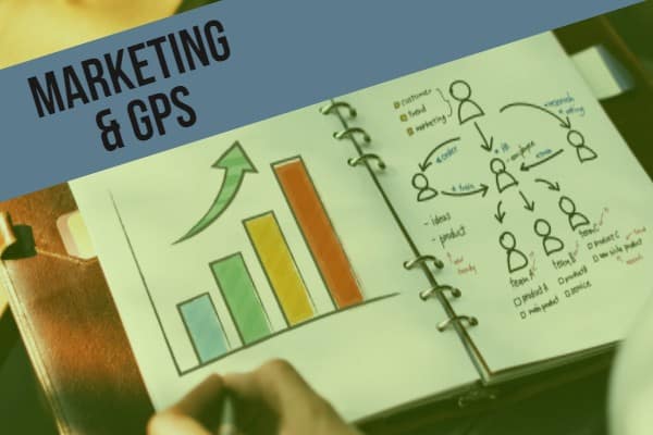
Welcome to the world of marketing and GPS fleet monitoring! In this post, we will discuss some slick marketing ideas with GPS fleet monitoring.

What is marketing?

First of all, let’s start with marketing. Here’s a quick question – what does marketing mean to you?

Most people would link marketing with ads or coupons. While ads and coupons does fall within marketing, marketing is not just about advertisements!

Marketing is about maintaining a relationship between a business and its partners. In other words, marketing includes creating new products, finding new customers, and keeping customers happy.

How does GPS for fleets help marketing?

In 2018, a lot of fleets are using GPS fleet monitoring to boost their marketing initiatives. For instance, 3 ideas include:

  • Engaging company drivers with in-house contests
  • Creating a new product line, and
  • Acting on customers with geofences.

Let’s discuss each idea.

Idea 1: Engaging Company Drivers

Marketing Challenge: Attracting and retaining talent.

One of the biggest fuel management challenges is finding and keeping good drivers. For instance, consider a recent study. By 2020, Canada is expected to have a shortage of 33,000 drivers. This is because older drivers are retiring and fleets are struggling to fill the gap. Hence, fleet managers are scrambling to find new ideas to keep good drivers.

Solution: Using data to engage drivers.

One trucking company used telematics to build relationships and run contests with drivers.

Firstly, fleet managers used data to market towards the drivers. “We feel that a lot of companies are missing the potential of GPS fleet monitoring,” explained a manager. “Rather than focusing on punishing drivers, we used telematics to monitor things like driver birthdays, job anniversaries, and so on. We then used this data to build our family culture by celebrating employees on internal newsletters.”

Secondly, fleet managers used telematics to incentivize drivers with contests. “We ranked drivers according to contest rules, like who drove the safest or who saved the most fuel,” said the manager. “Drivers enjoyed competing for gift cards and company recognition.”

Idea 2: Creating a New Product

Marketing Challenge: Standing out within an industry.

Auto insurance marketers face a tough challenge. The industry is repetitive; most insurers offer the same plans, just at different rates. Because of the competition, marketers have to think outside the box to stand out against the crowd.

Solution: Using telematics to make a new product.

Some insurers, however, are finding success by creating “premium pricing” plans with telematics. Here’s how the idea works.

First, insurance companies install tracking devices into their customer’s vehicles. Second, these devices track driver safety habits. Finally, the devices create reports to indicate driver performance. In the end, everyone wins. Why?

On the driver side, good drivers are rewarded with steep discounts. It’s a big incentive for them! On the insurer side, the company discourage risky drivers from their portfolio. As a result, the company saves on payouts.

Idea 3: Acting on Customers

Challenge: Communicating with customers on-the-go.

A big challenge for on-the-go businesses is communicating with potential customers. For instance, a company started a non-profit recycling project where customers trade used electronics for other goods at certain sites. How can marketers remind customers to show up when the truck shows up?

Solution: Using geofence alerts with an email and social campaign.

In this case, marketers used a geofence within a marketing campaign. Before we dive into how the campaigned worked, let’s discuss geofences. Geofences are a powerful GPS monitoring tool where users can draw zones on a map. With geofences, users get a vehicle’s estimated time of arrival (ETA) to a location and get alerts when vehicles arrive to the location. Now, how did marketers use this tool?

There were a few steps:

  1. First, marketers created a customer list by promoting the recycling initiative. Potential customers then registered on email and social media lists.
  2. Next, marketers used web analytics to categorize customers into different locations. Each location is then assigned to the nearest geofence.
  3. Finally, as the truck approaches the geofence, the marketing team automated emails to tell customers that their truck is arriving in a few hours.

As a result of geofencing, the marketers improved communication with potential customers and increased their recycling drive success!

Links
EY: The Quest for Telematics 4.0

Playbook: How to Improve Workload with GPS Trackers

A common business quote is “busy is good”. And busy is good! Being busy usually means a business is earning money. In the same way, fleets want more workload because that leads to higher income. In this guide, we will cover 4 ways to improve workload with GPS trackers.

Four proven ways to improve workload with GPS trackers include:

1 – Optimizing routes

2 – Increasing driver productivity

3 – Increasing task productivity

4 – Balancing telematics workload


Optimizing Routes

The first way to improve workload with GPS trackers is to look at route optimization. Route optimization means planning out the best route and increasing the number of jobs per day.

Here’s how it works.

Firstly, managers would look at different factors to determine job routes. This can include distance from jobs, traffic, weather, and customer preferences. Thankfully, GPS programs are powerful enough to calculate routes based on all of those factors.

Secondly, routes are shared with drivers. For a long time, managers sent emails or texts to drivers. However, modern fleet setups now include an in-vehicle navigation guide. For example, some companies have in-vehicle tablets and display routes on those tablets.

As a result of these two steps, managers can squeeze more jobs out of a day.

Increasing Driver Productivity

Another way to improve workload with GPS trackers is to focus on job efficiency. In other words, are drivers productive on their current routes?

An operations manager at a service company explains. “When we evaluate workload, one thing we look at is driver productivity”, said the manager. “We had a few unproductive drivers that took long breaks and did not start their job on time.”


In response to these challenges, the operation manager started measuring work productivity. “We were able to track productivity by measuring the percentage of time drivers spent on the road versus off the road. Soon after, drivers got the message and productivity improved.”

Increasing Task Productivity

Besides looking at driver productivity, another area is task productivity. Are employees spending their time on tasks that generate revenue for the business?

“Our company focuses on deliveries, so for us, making money means driving more. I found that our drivers were burdened with tasks like inspecting vehicles or completing delivery paperwork”, said a delivery business owner. “Sure, those tasks might take 10 or 15 minutes a day. However, that quickly adds up to over an hour per week where we can be on the road and making money.”

One idea is to use automated paperless software. For instance, some businesses use a computerized inspection system. Computerized programs collect diagnostics data from the vehicle and auto-fills inspection forms. Therefore, employees can go straight to the job rather than doing paperwork.

Balancing Telematics Workload

Finally, is it always useful to use telematics? The answer is actually no. There are times when GPS trackers can burden drivers.

Recently, there was an academic study on drivers that got in accidents because of telematics. The study refers to the “Multiple Resource Theory”, which states that humans only have enough visual, cognitive, and manual resources to focus on one task at a time. In other words, some drivers get distracted by their telematics system.


For example, some systems might have audio alerts whenever a manager assigns drivers a new job. The first instinct for some drivers is to check their notifications. Unfortunately, during that time, the driver stops focusing on the road and increases their risk of getting in an accident.

What’s the lesson? Businesses should learn to balance telematics and driving. For example, some businesses set up their system to only alert drivers of new jobs when their vehicle is stopped.

Click here for another article about improving workload with GPS trackers!

Links
University of Michigan: Driver Distraction, Telematics Design, and Workload Managers: Safety Issues and Solutions

Distracted Driving Laws & Policies

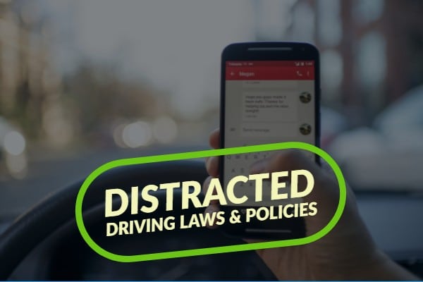
Did you know that April was Distracted Driving Awareness month? Distracted driving laws and policies are some of the biggest fleet management topics in recent years.


In this post, we will look at distracted driving laws around the world, sample distracted driving policies in fleets, and finally new anti-distracted driving technologies.

Distracted driving laws around the world

If drinking and driving awareness was the 20th century trend, then distracted driving awareness should be the 21st century trend! Many countries got the same memo and passed distracted driving laws.<p/)


Here are some examples around the world:


  • Canada: Canadian distracted driving laws vary by province. For example, Ontario recently toughened laws by adding a license suspension on top of a traffic ticket for distracted drivers.
  • US: Similar to Canada’s laws, cell phone laws vary by state. For instance, many states ban cellphone use while some states only ban cellphone use for new drivers.
  • Europe: Like North America, many European countries have strict laws. In the UK, your second distracted driving ticket leads to a 6-month license ban.


Clearly, many countries agree on having anti-distracted driving laws. The biggest challenge, like any laws, is enforcing the rules. Unfortunately, even with steep penalties, a lot of drivers still refuse to put down their phones.

Perhaps a good case study is to look at how some fleets enforced their distracted driving policies.

Example – Distracted Driving Policy

By 2018, most fleets have their own distracted driving policies. Some of the steps to implementing an effective policy include creating a policy, educating drivers on the policy, and enforcing the policy.

Creating a policy

Policies should be clearly written. A sample driving policy should include:

  • A mission statement to describe the objective, such as “providing a safe service”.
  • Rules to define how drivers must behave. For example, one business wrote that “drivers must not use cell phones while operating vehicles and must pull over to use their phone”.
  • Finally, there should be clear consequences for breaking the policy.

Educating drivers

After creating the policy, businesses must then educate stakeholders. There are two typical ways to educate drivers – formally and informally.

Formal education means company-endorsed events. For example, drivers should sign an agreement or managers should conduct distracted driving awareness workshops.

Informal education, on the other hand, are non-official but equally effective initiatives. For example, it might include company drivers who become role models and speak out against distracted driving.

Enforcing rules

Finally, the biggest success factor is being able to enforce distracted driving rules. Two common ways to enforce rules include:

Reporting system. A reporting system is when supervisors react to reports. Reports might include traffic tickets, public complaints, or camera footage.

Prevention systems. A prevention system is when supervisors prevent drivers from using phones. Some in-cab technology block cell phone use and prevent drivers from using their phones.


New Technology – Fatigue & Distracted Driver Camera

On a concluding note, anti-distracted driving technology growth is also matching cell phone technology growth.


A good example of such technology are distracted driver cameras. These cameras recognize distracted drivers by using facial scanning technology. ZenduCAM and SmartWitness recently developed a fatigue and distracted driver alert camera that detects events such as:


  • Distracted drivers that take their eyes away from the road for over 3 seconds.
  • Fatigued drivers that are closing their eyes or slumping forward.

Similar to how people stopped drunk drivers with ignition locks, new technology and ideas are stopping distracted drivers!

Links
CityNews: Ontario’s tough distracted driving laws one step closer to taking effect
IIHS: Distracted Driving
AutoNews: Texting and driving bans and fines worldwide