City of Charlottetown: Plow Readings
Company
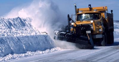
The City of Charlottetown is the capital of PEI, located in Canada. As a city in Canada, the municipality is responsible for plowing the road during a snowfall in order to keep the roads safe for all drivers. As safety is a top priority of the city, they realized that they were going to need a system to notify both them and their citizens when each road was plowed in order to be compliant with the minimum standards for plowing during a snowfall and avoid the liability if an accident were to occur on an unplowed road.
Opportunity
Traditionally, cities would monitor plow position using either magnetic sensors or hydraulic switches. When exposed to a rugged environment, these solutions do not work well. These solutions are hard to maintain and keep working when in rugged environments, and when they do break the solutions are so expensive that they almost become unfeasible to replace. A harsh environment will also lead to more inaccurate readings for the plows, which could be the difference between life or death in the middle or winter for drivers expecting plowed roads.
The system they need would have to measure when the plows were up or down. Knowing when the plow is down at a certain time in a certain location would allow the city to live-track which roads are clear for driving. Even though the city would then know which roads had been plowed, they would then need the solution to be able to present which roads had been plowed to the public.
Success
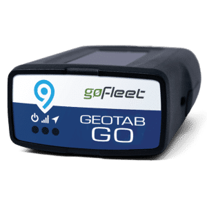
After considering all solutions on the market, the city of Charlottetown has now implemented both the eIONs plow position monitoring system (which uses clean and efficient air pressure technology) and the public maps add-in from GoFleet as part of their operations. When there is a snowfall, the city utilizes their new eIONs system to help track which roads have been plowed more accurately than before. Whenever the plow is put in the down position, the eION transmits that data based off of its air pressure system through the city’s GO7 Geotab GPS devices and then into their fleet manager’s database.
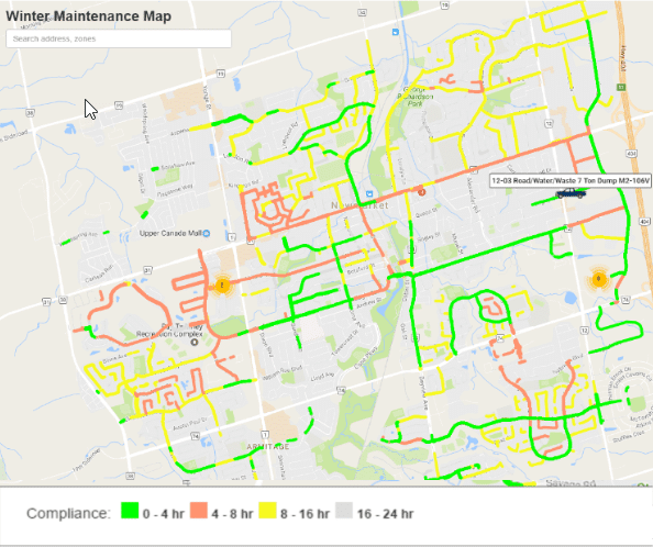
Within this database, plow activity is transmitted to an internal mapping view. Roads are color-coded based on the most recent plow pass: green for 0 to 4 hours, yellow for 4 to 8 hours, and red for more than 8 hours since the last plow. Using these tools together, they delivered a cost-effective, reliable solution that improves winter operations and helps protect citizen safety across multiple seasons.
See the Winter Maintenance solution